Staging version updated 12/5/2023

An initiative of the Center for Environmental Journalism at the University of Colorado Boulder

Home Blog Page 49

As the Salton Sea shrinks, it leaves behind a toxic reminder of the cost of making a desert bloom

The Salton Sea has shrunk dramatically over the last few decades, exposing miles of lake bed — and the toxic chemicals trapped there — that is sometimes stirred up as dust by the wind. Public-health experts fear that dust will exacerbate respiratory and other health problems that plague the residents who live nearby.

By Lindsay Fendt

Water Desk Grantee Publication

This story was supported by the Water Desk’s grants program, which operated from 2019 to 2023.

Archived info: grants for journalists

Read more grantee stories »

It’s just past noon on a Wednesday, but the bar at the Ski Inn in Bombay Beach, California, is already packed. The crowd is mostly Canadian, snowbirds escaping to the desert spas and country club communities that dominate this southeastern corner of the state, just 50 miles from Mexico. Bombay Beach is not their destination, just a side trip to see the ruins of the once-famous party town.

In the 1950s, Bombay Beach was a celebrity destination. Frank Sinatra, the Beach Boys and Bing Crosby frequented its luxury resorts perched at the edge of the Salton Sea, California’s largest lake. Lauded for its fishing, boating and water skiing, the Salton Sea attracted more visitors than Yosemite National Park. Birds, too, loved the lake, with thousands spending winters there every year.

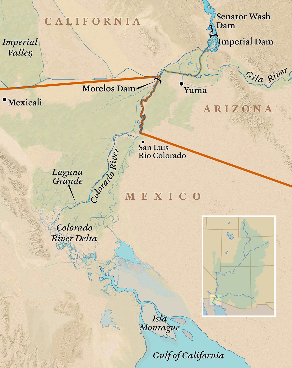
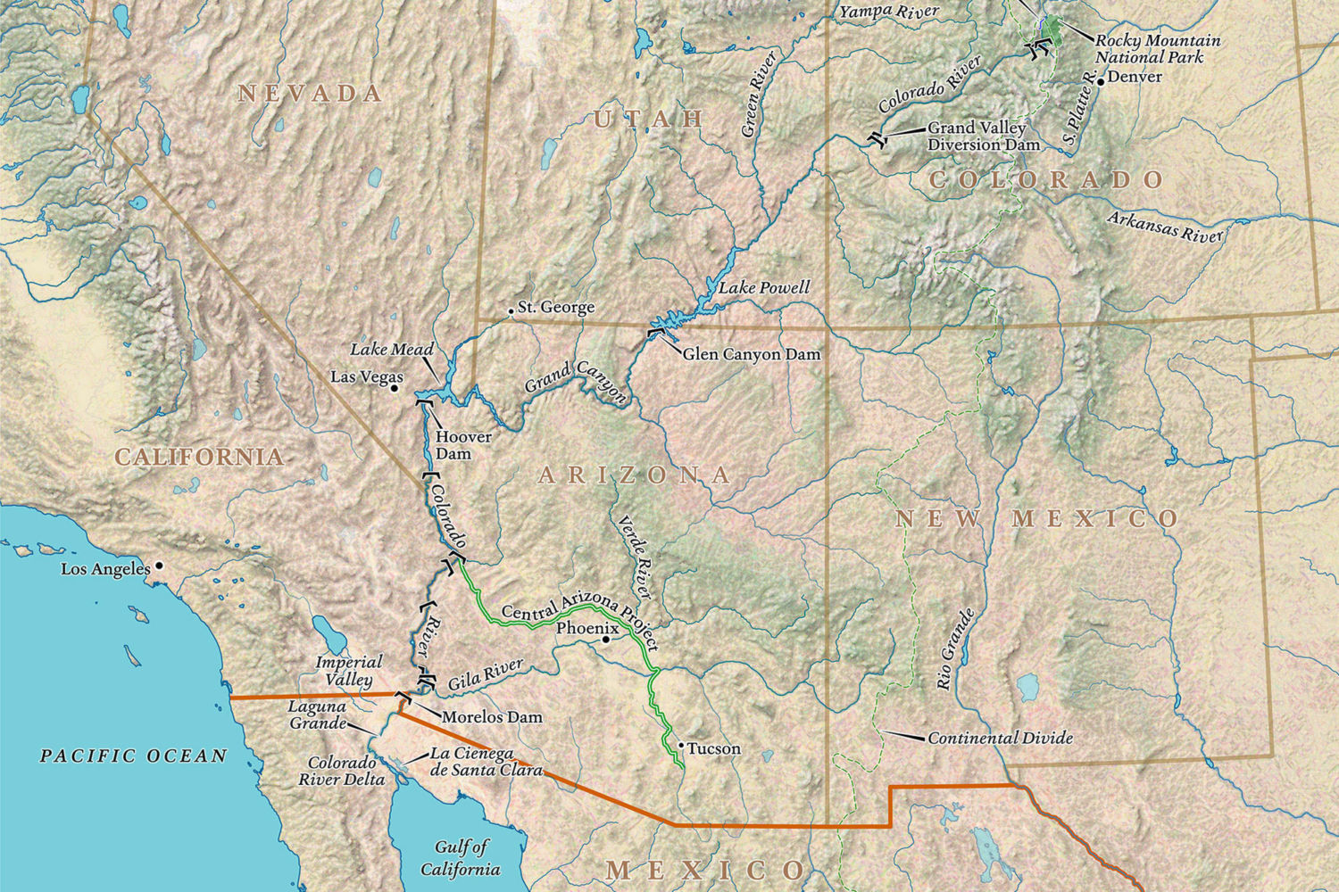
The lake was formed in 1905, after the Colorado River breached an irrigation canal and flooded the Salton Sink, a basin in the desert that has periodically held lakes throughout history. Once the canal was repaired, two years later, the Salton Sea had no source of water other than the runoff that flowed in from the nearby farms of the Imperial Valley, one of the state’s agricultural hubs. 

This runoff water, full of chemicals and nitrates, was saltier than the lake water. As it drained through the soil, it combined with ancient salt deposits, raising the salinity even further, and in the 1970s scientists started warning that change was coming to the Salton Sea. The salt would transform the lake, causing it to shrink and making it inhospitable to wildlife.

Sure enough, before the decade was up, fish started dying off and bird populations declined. The lake began to stink, spurring the state to issue periodic odor advisories that sometimes extended as far away as Los Angeles. Today, the lake is about twice as salty as the Pacific Ocean.

“It’s a drastic change,” said Jane Southworth, the only local at the bar, who came seasonally to Bombay Beach before settling here for good in 1990. “It went from fun to no fun. From water to sand, or I should say mud.”

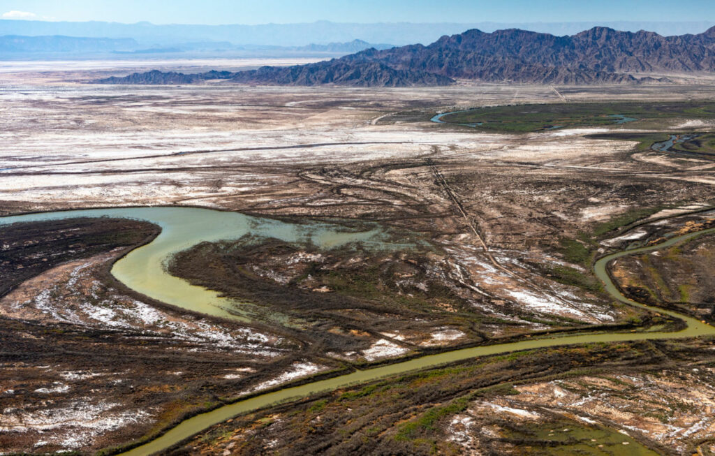
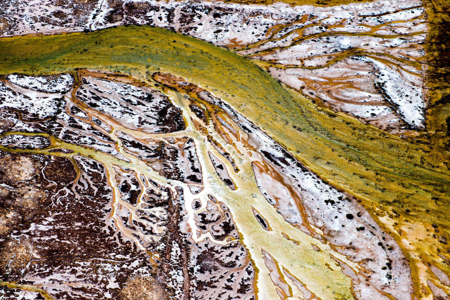
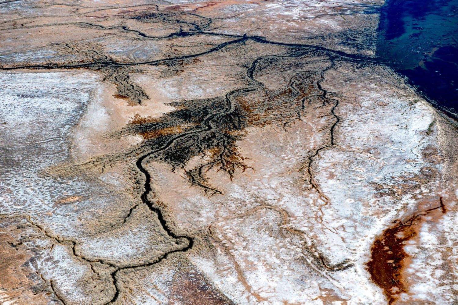
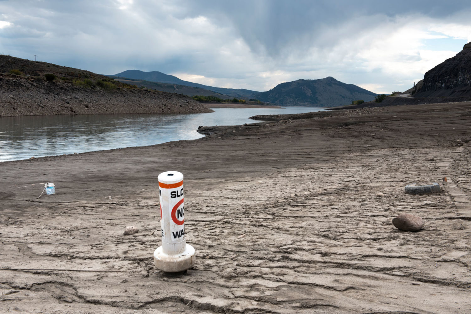
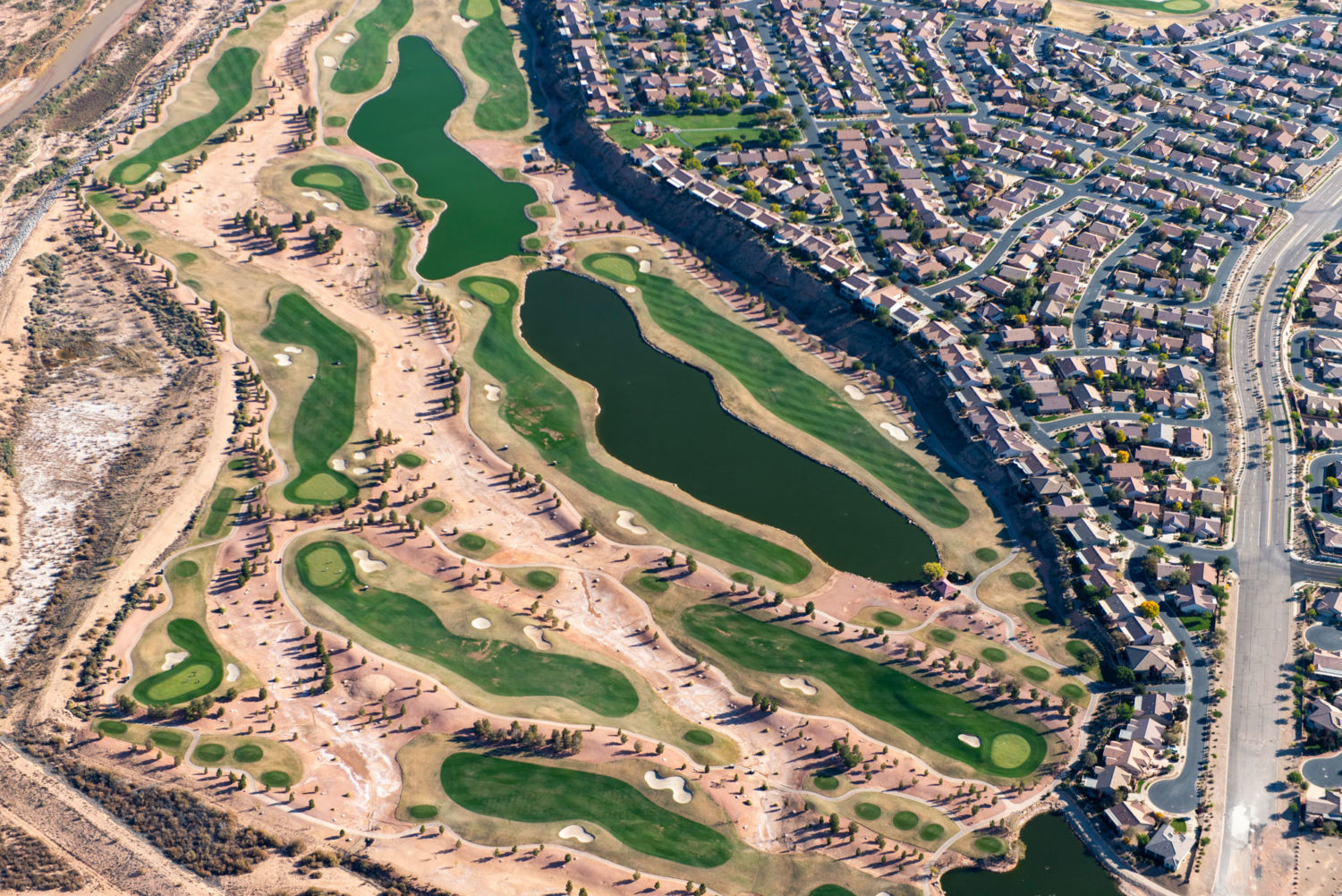
Now the Salton Sea has another problem: Climate change is making this dry region even drier. And a growing demand for water in the booming cities and suburbs of Southern California has reduced the amount of Colorado River water diverted to nearby farms. In the coming years these two factors are expected to dramatically increase the pace at which the lake shrinks, exposing more lake bed and the agricultural toxins trapped in the mud. 

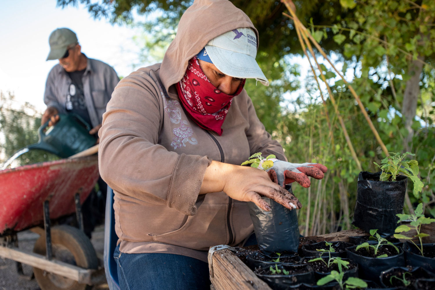
The desert winds lift dust from the lakebed, and scientists fear that eventually the toxic residue of more than a century of agricultural runoff will be blown into the air — and into the lungs of residents. The area surrounding the Salton Sea already has some of the worst air quality in the country, caused by particulate matter swept up from farms and the desert. Local residents have some of the highest rates of asthma and other respiratory problems in the state, and public health officials say the heavy metals and chemicals in the lake bed pose an even greater threat.

Tourists stroll along Bombay Beach, home to a dilapidated resort town that once was a celebrity hotspot. Photo credit: Lindsay Fendt

Many of the people and businesses that once relied on the lake have left, driven away by the smell of dying fish or the fear of health problems. Those who remain — farmworkers, families, the elderly — are generally too poor to afford the rising cost of property elsewhere in the valley. Others, like Southworth, who’s retired, have too many fond memories of the lake to give up on its future.

“I just wish they would do something, put some water out there,” she said.

 A slow-moving disaster

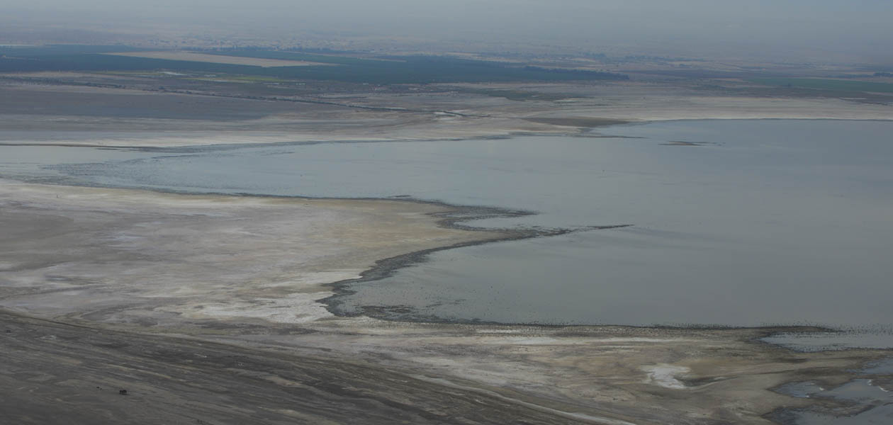
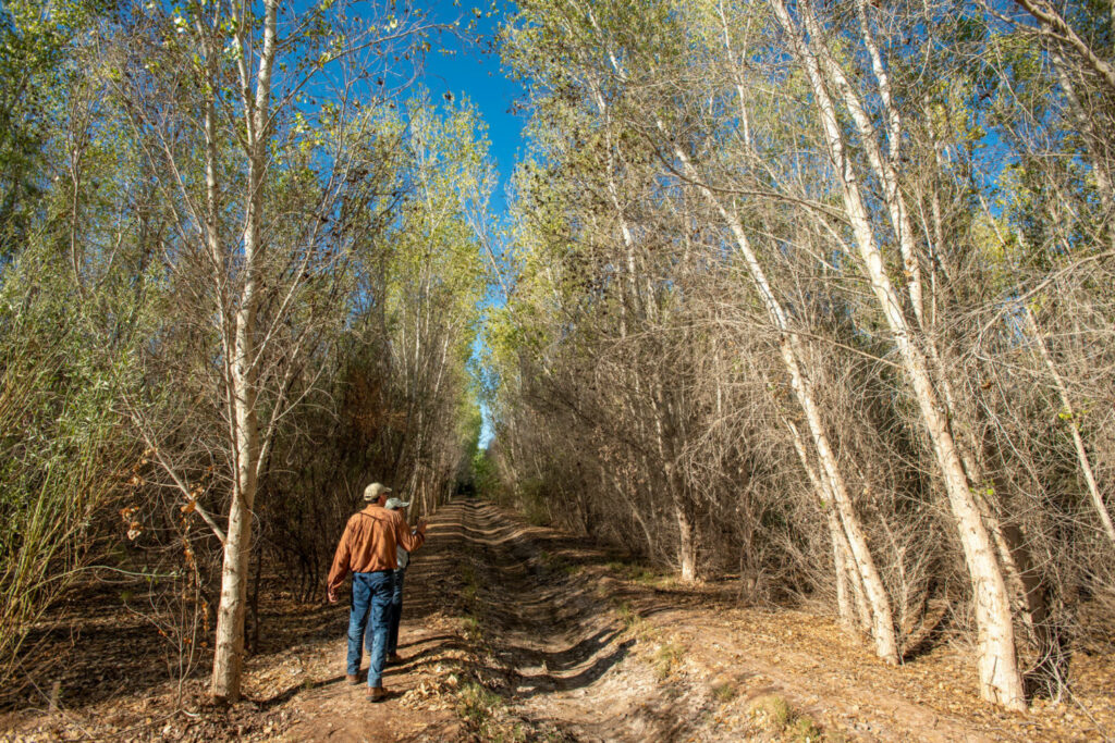
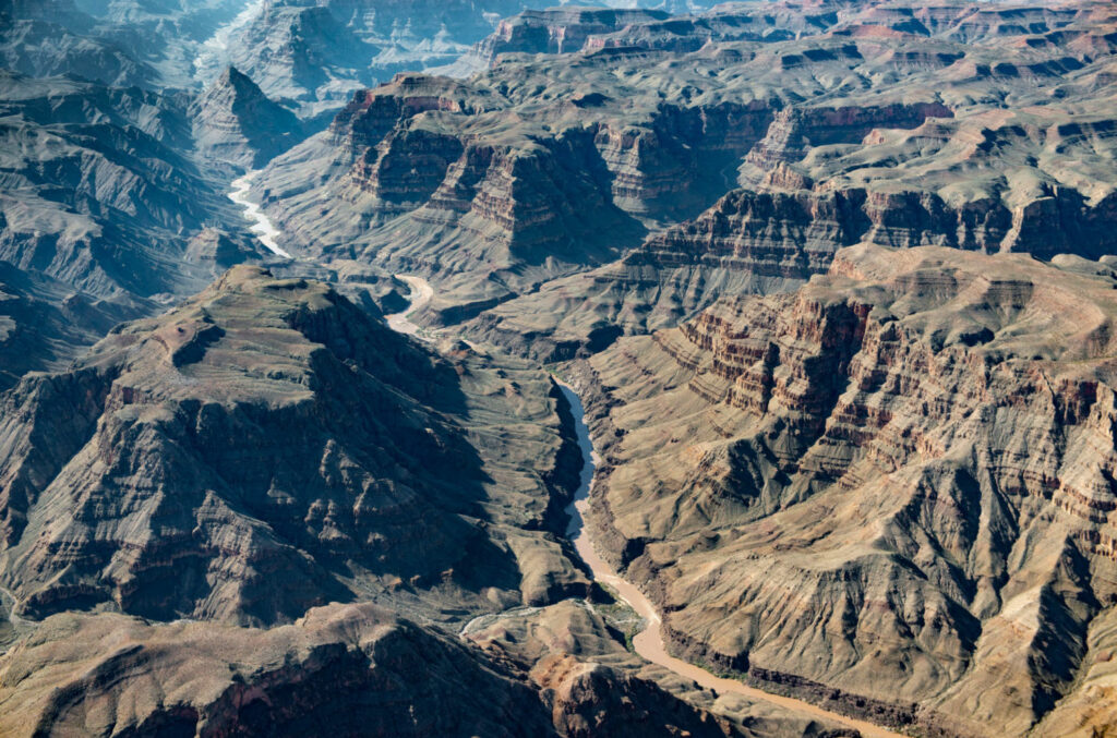
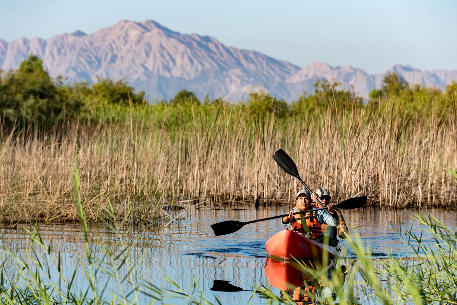
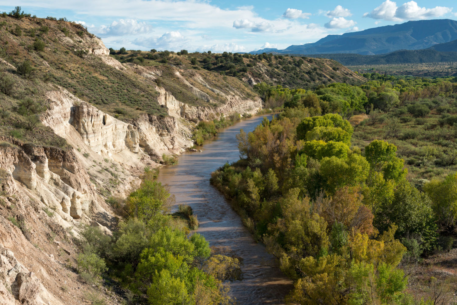
To understand the Salton Sea — its massiveness, its unlikely place in the desert of Southern California — it’s best to see it from above. In November, I boarded a four-seat plane with Frank Ruiz, the Salton Sea program manager for the Audubon society. We took off from a small airstrip in Thermal, north of the lake, and soon the lake flooded our view from the window. 

It seems unnatural, the shimmering water surrounded by chalky sand and cactus. But water has found its way into this desert basin repeatedly throughout history. Before dams and other diversion structures fixed the Colorado River on its current path, the river used to periodically migrate across the floodplain, changing course to circumvent sediment that had built up in previous seasons. Sometimes it emptied here in the Salton Sink. During one such period, the river sustained an even larger lake, Lake Cahuilla, that stretched from the Coachella Valley, up by Palm Springs, all the way to northern Mexico. 

We fly near the Chocolate Mountains that rise up south of the Salton Sea, and Ruiz points to a discolored line high on one of the ridges where a thousand years ago lake water once reached.

“If you talk to anyone from the Cahuilla tribe, the people who have been in this basin forever, they say water has always been here,” Ruiz said. “So this isn’t just about saving some artificial lake.”

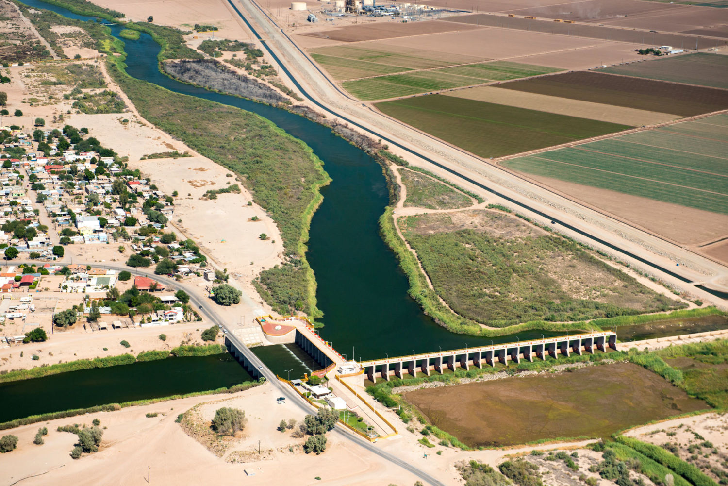
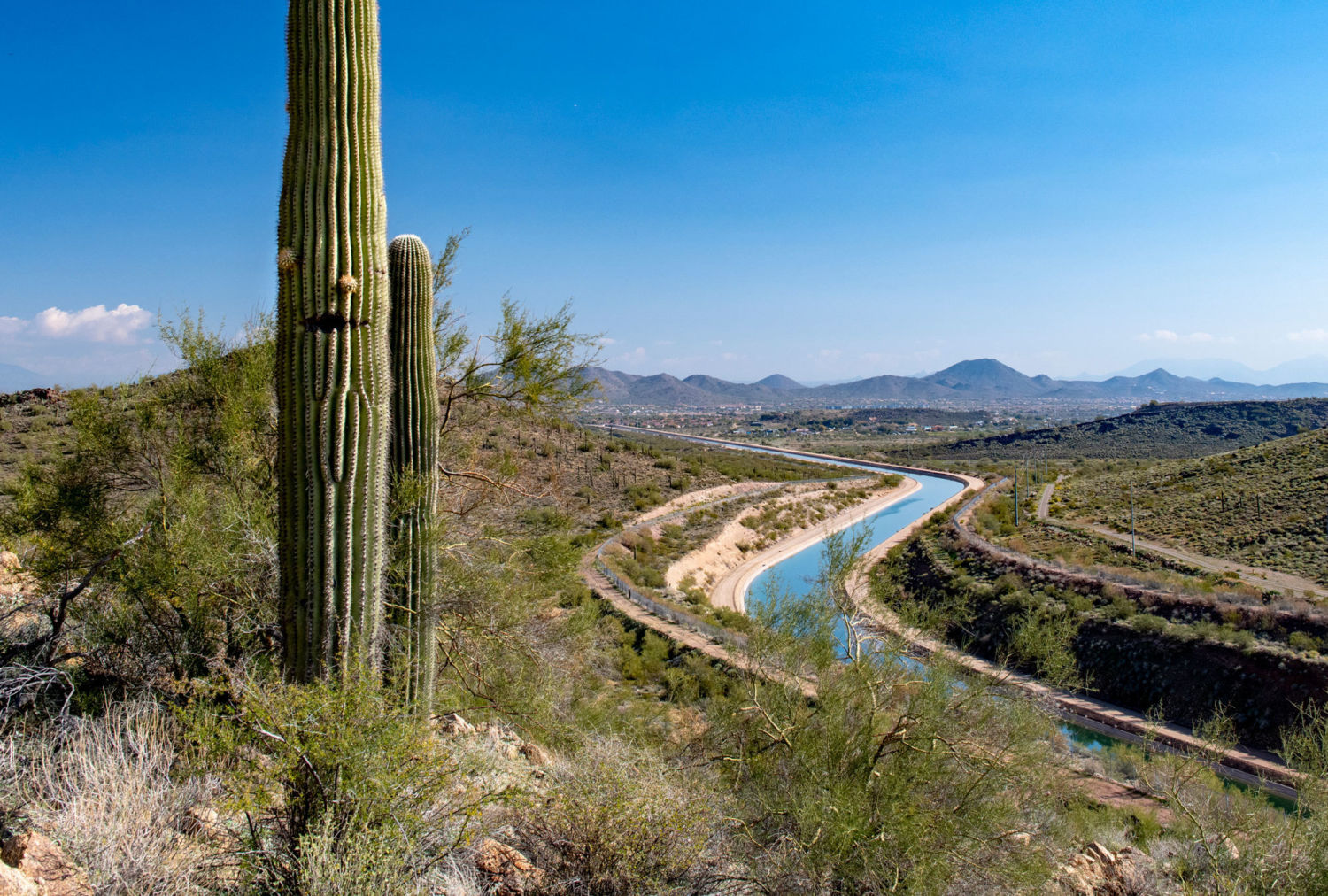
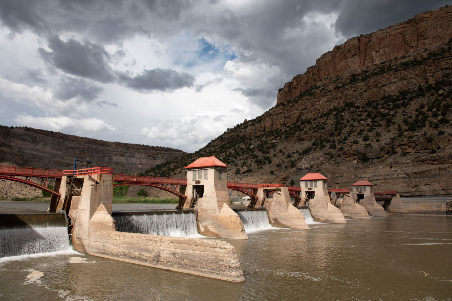
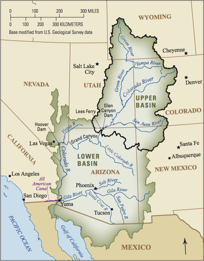
Lake Cahuilla dried up sometime in the 16th century after the river again shifted course, this time to the Gulf of California. Dams have tamed the river’s meandering, and it’s unlikely the Colorado will ever find its way into the Salton Sink again. Yet the river’s water is still coming, diverted into the desert via the 80-mile-long All-American Canal.

There are more than 500,000 acres of farmland in the Imperial Valley. All of it is irrigated with water piped in from the Colorado River through the 80-mile-long All-American Canal. Photo credit: Lindsay Fendt

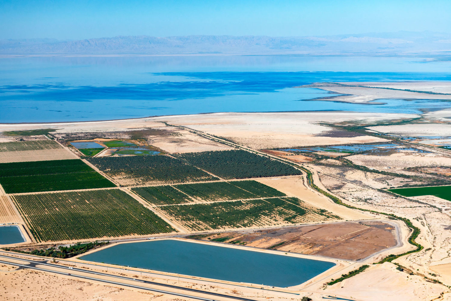
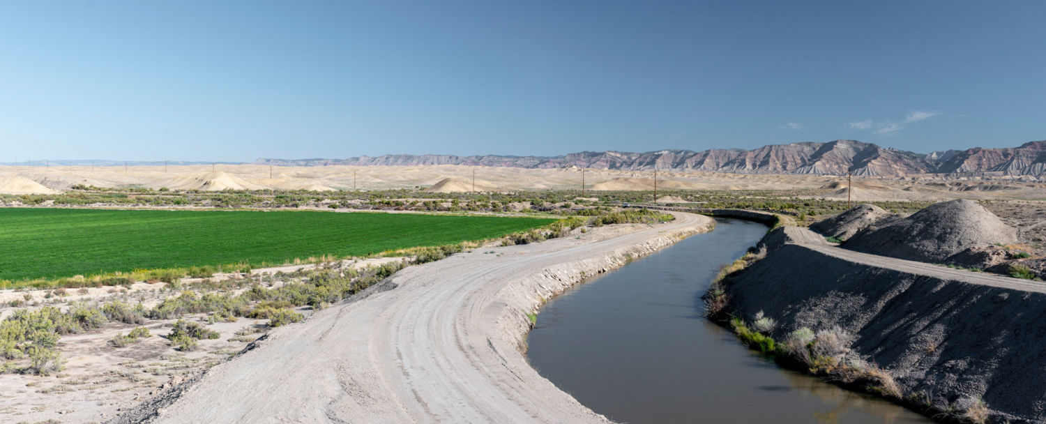
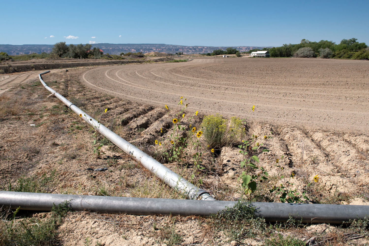
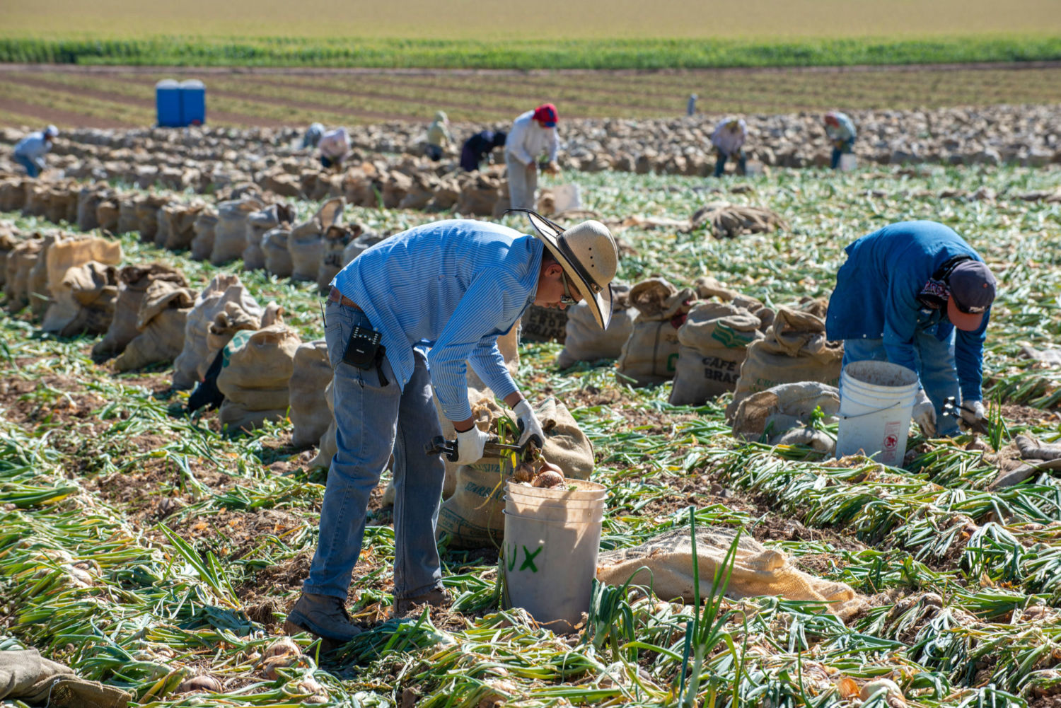
As the plane veers back, heading to the south side of the Salton Sea, more than 500,000 acres of farmland unfurl beneath us. This quilt of green is the Imperial Valley, home to some of the world’s most fertile soil, enriched with minerals from the Colorado River floodplain. 

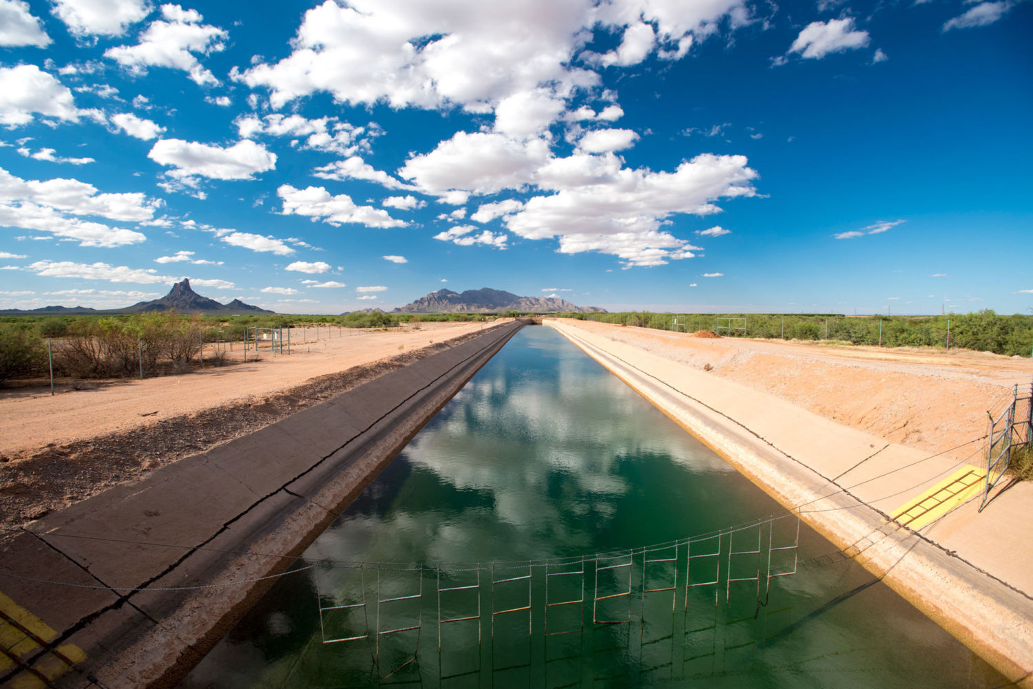
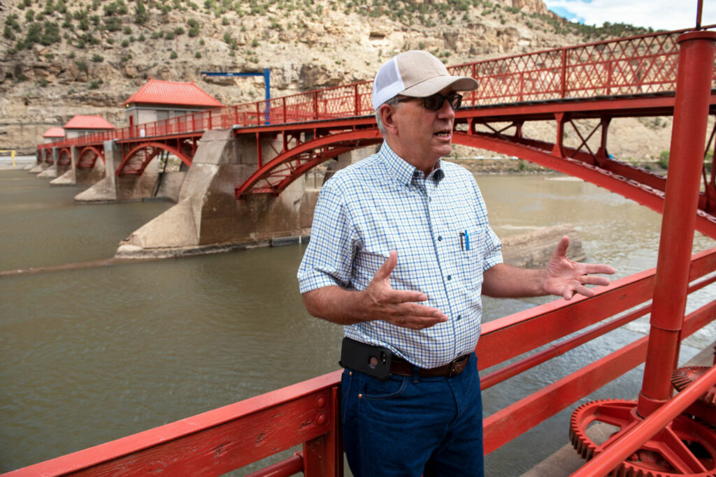
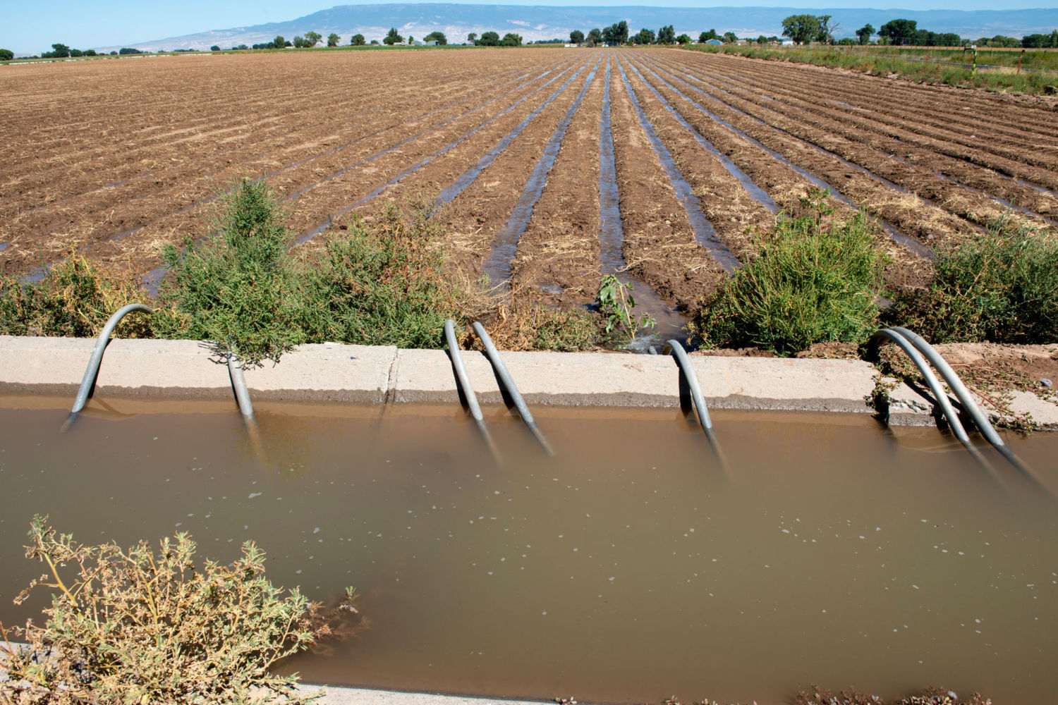
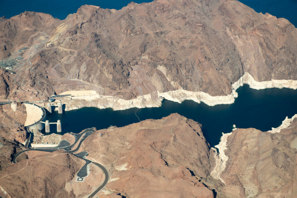
The valley produces as much as two-thirds of the country’s winter fruits and vegetables, but sustaining that level of production in a desert has a cost. The Imperial Irrigation District, which manages the canal and the sprawling network of pipes and irrigation ditches it feeds, diverts 2.6 million acre-feet of water from the Colorado, about half of California’s entire allotment from the river. For perspective, it takes about 2 acre-feet to fill an Olympic-sized swimming pool.

The valley’s agricultural boom is what created the Salton Sea. In 1905, flows on the Colorado River were unusually high and the river breached an irrigation canal that carried water to the valley. Unimpeded, the river shifted course toward the dry sink that once held Lake Cahuilla. The canal was fixed in 1907, but by then water covered 515 square miles. 

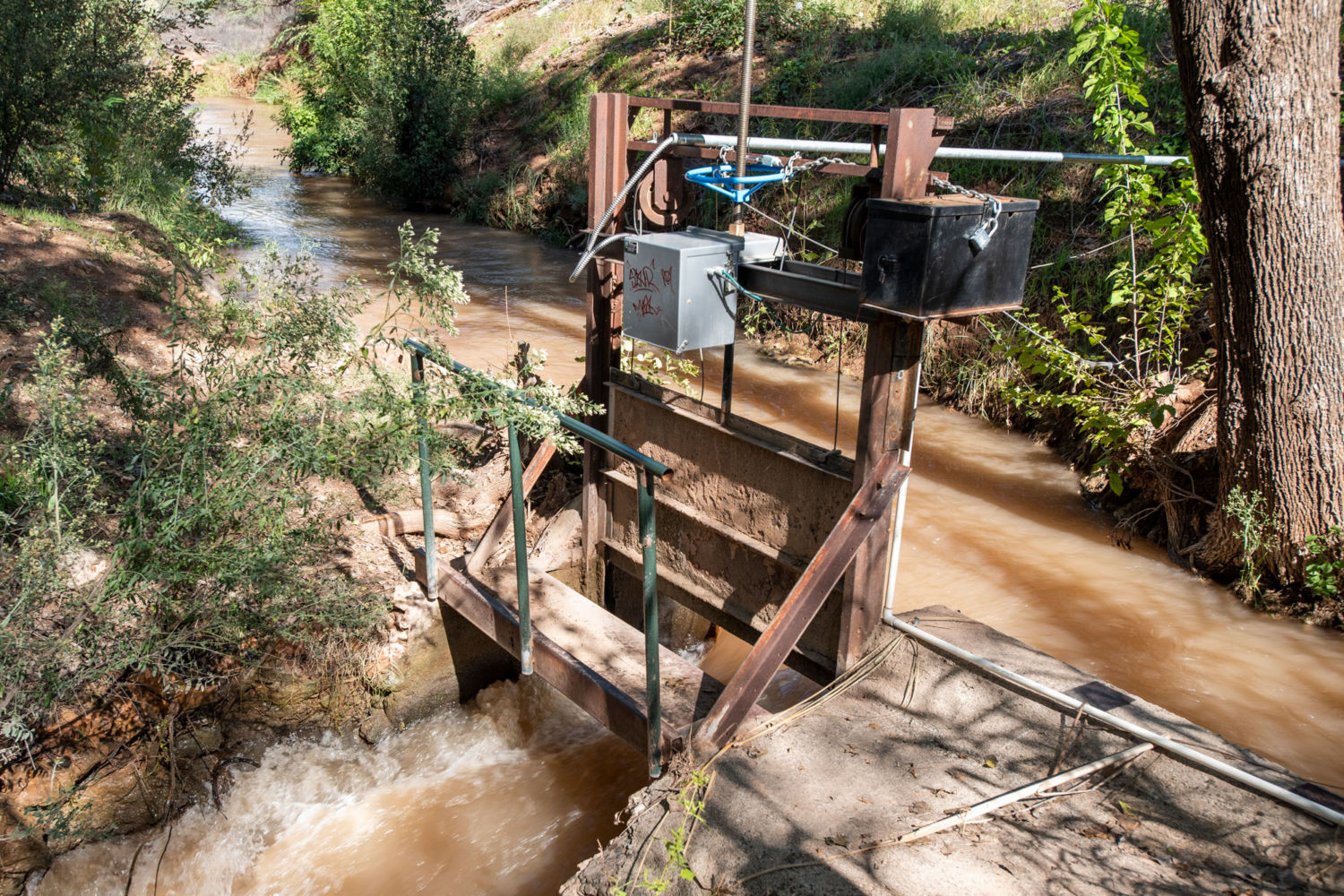
The lake would have eventually evaporated were it not for the wastewater that drained into it, mostly from the surrounding farms. This runoff included enough fresh water to sustain the Salton Sea for decades, but it also brought pesticides and herbicides, including now-banned chemicals like DDT and other cancer-causing compounds, all of which settled in the mud at the bottom of the lake. The inflows varied widely, but sometimes reached as much as 1 million acre-feet a year.

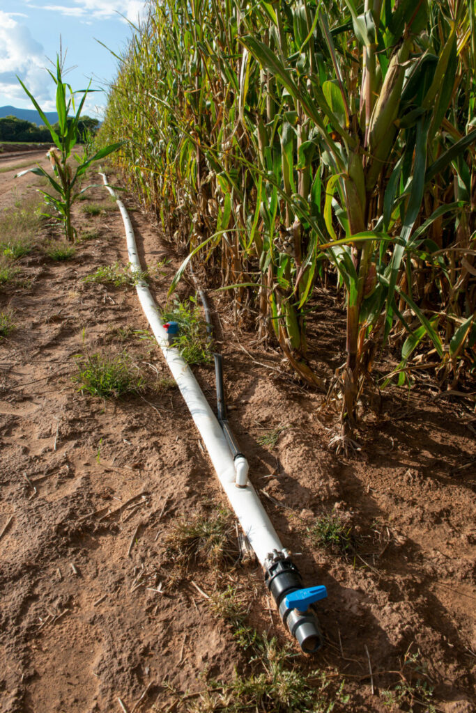
Then, in 2003, the Imperial Irrigation District agreed to agreed to conserve water and transfer the savings to San Diego County. Farmers were forced to abandon flood irrigation, a wildly inefficient strategy that involved flooding the fields and letting the excess run off. Farmers in the valley began using drip irrigation, diverting less river water and allowing San Diego and the Coachella Valley to take the excess. This change meant there was enough water for everyone — but not for the Salton Sea.

The Alamo River carries runoff from nearby farms into the Salton Sea. That runoff has filled the lake bed with decades worth of pesticides, including banned chemicals like DDT, as well as nitrates from fertilizer, raising the lake’s salinity higher than that of the Pacific Ocean. Photo credit: Lindsay Fendt

“There is this tension because we want to use water more efficiently instead of building more dams,” said Michael Cohen, a senior researcher with the Pacific Institute, an environmental group focused on water policy. “But the unintended consequence of that is that less water goes to the Salton Sea because it is entirely dependent on inefficiency.”

To stave off the lake’s evaporation, the irrigation district continued to put 800,000 acre-feet of water directly into the lake as it implemented efficiency measures. Those water deliveries ended in 2018 and in the coming years the pace of the Salton Sea’s evaporation is expected to triple.

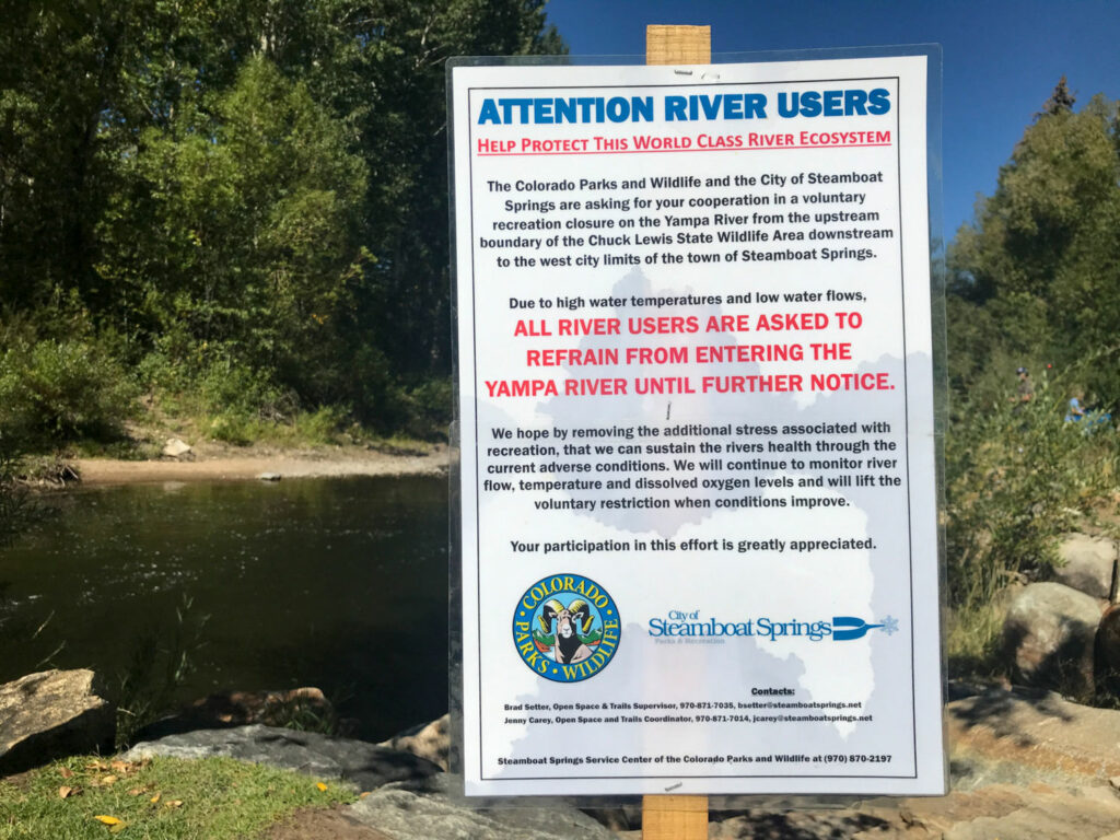
In return for improved water-use efficiency, the state of California was supposed to implement a plan to control dust and reduce habitat loss for migrating birds on the Salton Sea by 2018. But that plan stalled, the lake continues to shrink, and a public-health crisis looms.

A forgotten place

In 2017, researchers from the University of Southern California partnered with the Comite Civico del Valle, an environmental justice group based in Brawley, an agricultural town just south of the Salton Sea for the first comprehensive study of child respiratory health in the region. 

The study’s researchers are using data from air quality monitors at schools surrounding the Salton Sea, analyzing the composition of dust coming from the Salton Sea and collecting health data from 500 children in the area to determine how the Salton Sea may change air quality in the region and impact health. Preliminary results confirm the community’s concerns about respiratory problems in children.

The valley’s air frequently falls below federal air-quality standards. One in five children in the area surrounding the Salton Sea have asthma, a rate three times higher than the rest of the state. The reasons for the elevated rates of pollution aren’t fully understood, but it is likely a combination of both natural and chemical dust from farms, the desert and the lake.

“We don’t have any evidence at this point that the existence of the Salton Sea is bad for respiratory health on its own,” said Jill Johnston, one of the researchers on the study, noting that there are a number of factors. “The community is cumulatively burdened, and we know that there are other sources of air pollution going on, but we think that adding in the [Salton Sea] dust without any mitigation can make things worse for children.”

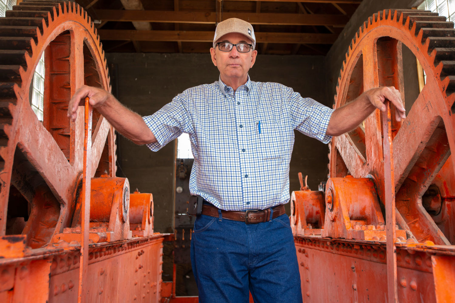
Ryan Kelley, chairman of the Imperial County Board of Supervisors, grew up in Brawley. He was a firefighter and a paramedic before he decided to get into politics. He applauds to efforts of local activists, like Comite Civico del Valle, but says Imperial County has been forgotten by the state and federal governments.

Imperial County has one of the highest unemployment rates in the country, and in 2016 one in four people there lived in poverty. It has some of the worst air quality, too, and the active asthma rate is 12.1 percent, higher than both the state and national averages. But according to Kelley, the county isn’t a priority in the region which includes some of wealthiest communities in the state in nearby San Diego County, the Coachella Valley and Palm Springs. 

A shed in Bombay Beach is sprayed with graffiti that reads ‘toxic waste.’ Public-health experts worry that dust from the exposed lake bed will exacerbate respiratory problems in the community. Photo credit: Lindsay Fendt

“When you think of Southern California how often do you think of Imperial County?” Kelley asks. “We don’t have that much in common with San Diego anymore, and our problems get swallowed by these larger, wealthier places.”

What’s happened to the Salton Sea is a case in point. It has been in decline for Kelley’s entire adult life, affecting the health of both residents and the local economy. Tourists are afraid of the potential health issues from the lakebed’s dust and are put off by the frequent odor issues brought on by dying fish. Businesses don’t want to come to Imperial for the same reasons. 

Solutions to these problems have been on California’s drawing board for more than a decade and still have not been finalized. 

The California Natural Resource Agency released the official Salton Sea Restoration Plan in 2007. The basic premise was to redirect the remaining inflows to the Salton Sea to small, man-made wetlands that would both suppress dust and create bird habitat. 

From the outset, the plan lacked funding, and over the years promises of money and action from state lawmakers would arise and evaporate as priorities shifted and water politics changed. 

The lack of official action has led to a cascade of alternative plans from environmental groups, advocacy organizations and local governments. Some have proposed piping saltwater in from the Sea of Cortez, desalinating it and returning the lake to its original size. Another plan calls for distributing the water along the lake’s outside to reduce dust, letting the middle dry out. Another group has proposed a complicated strategy that involves releasing foam block islands onto the lake to support new vegetation that would filter salt from the lake. All these plans, including the state plan, lack funding and official rights to any water beyond wastewater.

While there are very real hurdles for moving forward on the plan, Kelley says a lack of political will in Sacramento, the state capital, underlies the failure to act. That may be starting to change.

In recent years, the Imperial Irrigation District, the most powerful entity in the valley, has expressed frustration at the lack of action, suggesting it may abandon the 2003 water-transfer agreement with San Diego County if something isn’t done to fix the Salton Sea.

“The premise in which the [water transfer agreement] was finally agreed upon was having the state of California address the issues of the sea,” said Henry Martinez, the general manager of the Imperial Irrigation District. “There is a question of at what point that agreement is breached.” 

Under a new governor, Gavin Newsom, who took office last year, and new leadership at California’s Natural Resources Agency, the state has made some progress on the land-access issues and secured easements to begin some of the dust suppression and habitat restoration projects. Even with this progress, the state is still behind on the planned 10-year project. The government rhetoric has shifted, too, with officials making public statements about the importance of addressing the problems caused by the Salton Sea’s evaporation.

“I can’t really go back and fix the things that happened in the past,” Arturo Delgado, the new Salton Sea Secretary for the Natural Resources Agency told me in November, “but we made a commitment.”

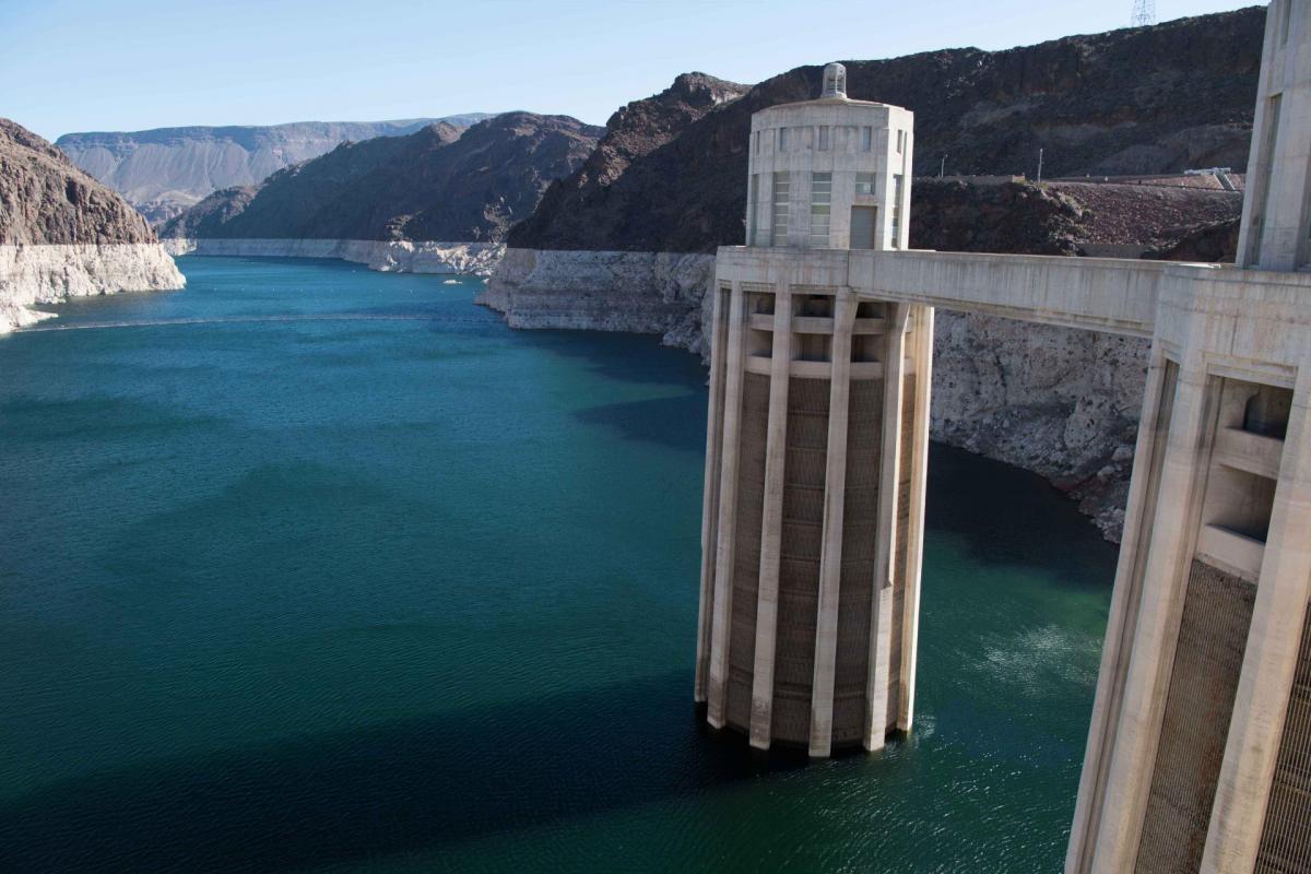
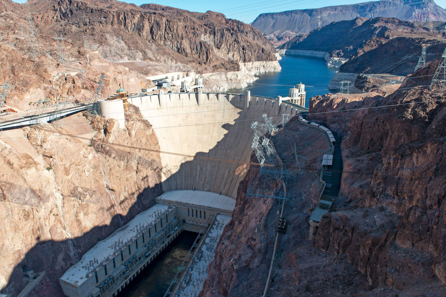
Last Spring, though, the seven states that use Colorado River water agreed to a plan that would reduce the amount of water each would take from the river in certain conditions. Water politics are notoriously fraught in the West, but declining water levels on the Colorado, following a 20-year drought, forced the states and other major users of the river’s water to reach a deal. 

Despite pressure from Imperial Irrigation District, the deal did not include money to clean up the Salton Sea. 

Dan Cooper, a biologist with Audubon California, works on the group’s monthly bird count around the Salton Sea. It’s considered one of the most important sites along the Pacific Flyway, a major migratory path between Canada and Mexico. But as the waters have receded and the fish die off, the number of fish-eating birds has plummeted, with some species almost entirely gone. Photo credit: Lindsay Fendt

In October, the Imperial County Board of Supervisors declared a local air pollution emergency at the Salton Sea. In November, the board declared another emergency, this one at the heavily polluted New River, which empties into the Salton Sea. Ryan Kelley hopes to use the local emergencies to cut through some of the red tape holding back the restoration projects. If the state were to declare an emergency, it could secure federal funding and expedite the permitting process.

Delgado says the state is reviewing the board’s declaration but has not yet decided whether to move forward with it. Meanwhile, the lake continues to dry up at a faster rate than ever before.  

“There was always a concern that when water stopped flowing to the Salton Sea that it would have an effect,” says Henry Martinez. “Fast forward to what is happening today. It appears we are at least getting close to the tipping point.”

Correction: The story has been changed to reflect the fact that the Imperial Irrigation District did not transfer a portion of its rights to the Colorado River water to San Diego County in 2003. Rather, the IID agreed to be more efficient in its water usage and send the conserved water to San Diego County. 

You made it this far so we know you appreciate our work. FERN is a non-profit and relies on the generosity of our readers so that we can continue producing incisive reporting like this story. Please consider making a donation to support our work. Thank you.

This story was produced in collaboration with The Weather Channel, where it first appeared. All rights reserved. Reporting was supported by The Water Desk, and aerial support for photos provided by LightHawk. This article may not be reproduced without express permission from FERN, where it was published January 13, 2020. If you are interested in republishing or reposting this article, please contact info@thefern.org.

Video story: Cooling the Yampa river (full length)


By Jerd Smith and This American Land

As climate change brings warmer weather, Westerners are looking for ways to protect the region’s rivers and streams. In a special report for the Water Desk, Jerd Smith of Fresh Water News explains a strategy for safeguarding Colorado’s Yampa River.

This video story was produced for The Water Desk by public television’s “This American Land.” Reporter: Jerd Smith. Producer and Editor: Dave Timko

Back to top

Small farmers wait for California’s groundwater hammer to fall

Randy Fiorini walking in his walnut orchard
Randy Fiorini in his Merced County walnut orchard. Five years ago, the Fiorini home’s groundwater well ran dry. With groundwater limits likely to be on the way, he wonders if he’ll be able to continue to rely on a critical backstop during droughts. (Madison Pobis)

A black lab trots dutifully behind as Randy Fiorini proudly points out the drip irrigation lines running along the base of his walnut trees. The orchards sit on land first planted in 1907 when his grandfather established Fiorini Ranch a few miles outside of Delhi, California after relocating from Redondo Beach. A cement ditch carrying water from the Don Pedro Reservoir about 50 miles away runs alongside peach, almond, and walnut trees.

Back when the ranch was irrigated by flooding its fields, Fiorini would splash around with his childhood friend, Scott Severson, in the huge pools under the shade of the trees. Like Fiorini, Severson grew up to farm his family’s ranch nearby in Merced County.

Like most parts of the Central Valley, the Fiorini and Severson ranches in the Turlock Irrigation District used surface water when it was available, and pumped groundwater when it wasn’t. Two decades ago, Fiorini decided to use water more efficiently and switched from flooding to drip irrigation on his peach trees, tripling the production of cling peaches. His overall water use didn’t fall, and the years of reliance on groundwater took its toll. Five years ago, in the middle of a crippling drought, Fiorini’s domestic well pump no longer reached the shrinking groundwater aquifer.


Video Profile: Randy Fiorini, Third Generation Grower

“You don’t have enough water and you lose those trees, you’re gonna be sideways with the bank in a hurry.”

Fiorini switched from flooding to drip irrigation on his peach trees, tripling production but continuing his orchards’ reliance on groundwater.

Video: Madison Pobis/Bill Lane Center for the American West

His land is part of roughly five million irrigated acres in the San Joaquin Valley distributed over about 20,000 farms. As Fiorini’s domestic well ran dry, underscoring the speed at which this crucial resource was disappearing, the California legislature took action to end more than a century of freewheeling, unregulated groundwater use. In 2014, it approved the Sustainable Groundwater Management Act. Basin by basin, local areas had to create new agencies — called groundwater sustainability agencies, or GSAs — to manage the groundwater.

Now farmers, large and small, are beginning to grapple with what this means for them and their choice of crops. Many expect to see cutbacks on pumping once the Sustainable Groundwater Management Act (SGMA) is fully implemented.

The groundwater basin underneath the ranches of Fiorini and Severson in Delhi is one of 48 in the state that is considered “high priority.” Its Groundwater Sustainability Agency, the West Turlock Subbasin GSA in Merced County, must submit plans by January 2022 that will bring it into a sustainable balance in two decades.


Map of California groundwater basins showing prioritization.

Map of California groundwater basins showing state prioritization levels. Click for interactive map. Geoff McGhee/Bill Lane Center for the American West

“Growers are starting to take notice,” said Scott Severson. “Some adapt much faster than others… And there’s a certain portion that will dig in and wait until the very end until they’re mandated what to do, and you know scream and yell about it the whole way.”

Chart: Groundwater use in wet vs dry years

Some farmers will find out their new limits soon. The state Department of Water Resources is already reviewing three sustainability plans. The sustainability agencies with authority over Al Rossini’s scattered farmland are responsible for two of California’s 21 critically overdrafted basins. Like Fiorini and Severson, Rossini’s family has farmed about 1,000 acres for generations. The Rossini acres are in both Merced and Stanislaus Counties; the relevant GSAs must submit their plans to the state at the end of this month.

What are farmers like these doing? Waiting. Most want their new GSAs to spell out precise limitations before hitting the brakes on production.

When they are told of the actual groundwater cutback requirements, they will face a reckoning. The Public Policy Institute of California (PPIC) estimates that since 2003 the San Joaquin Valley has overdrafted an average of 2.4 million acre-feet of groundwater every year. (An acre-foot is about 326,000 gallons, or enough to supply water to two homes for a year.) Bringing California’s groundwater supplies into balance will require huge sacrifices from growers — some may see cutbacks as high as 50 percent on groundwater pumping. Farmers must also rethink which crops are worth keeping and how many acres can be sustained with limited water supplies.

Even under ideal conditions, the PPIC estimates that a minimum of 535,000 acres will need to stop producing crops by 2040, with landowners forfeiting billions of dollars in revenue. If new water supplies can’t be generated or redistributed, that number might be as high as 780,000 acres, according to Jelena Jezdimirovic, a research associate at the PPIC. “We kind of don’t take these numbers to be the absolute truth of what will happen,” she said, “but we want to show that, depending on how people want to implement this law, there is potential for better outcomes.”

Jezdimirovic said that it’s not all that surprising that most basins haven’t settled yet on firm allocation limits. Yet inevitably, land will come out of production and landowners will have to decide how — and how much — to fallow. The decisions of smaller family farmers may be wrenching, and they own a substantial portion of the land affected. In a 2017 PPIC report Jezdimirovic wrote that in the Central Valley, “farms with less than 500 acres of irrigated cropland account for a quarter of total irrigated acreage.”

A few farmers have acted already. Sarah Woolf Clark, a grower in the Westlands Water District, said her family operations had to cut production in 2009, when their surface water allocation dropped to zero. They reduced staff and eliminated equipment to scale back on two thirds of their property. They haven’t returned to full capacity, and are rotating lower-value row crops, diverting more water to their higher-value almonds and pistachios, and slowly divesting themselves of water-stressed areas.


Micro irrigation watering an almond orchard in Livingston, California in 2015. Most growers have already invested in more efficient methods of irrigation like these to increase yields

Micro irrigation watering an almond orchard in Livingston, California in 2015. Most growers have already invested in more efficient methods of irrigation like these to increase yields. Lance Cheung/USDA via Flickr


Many farmers must face the consequences of deciding to shift to permanent crops. Once planted, grapevines or nut trees must be watered, drought or no. The increasing dominance of high-value perennial crops — which now represent 45 percent of the production in the southern Central Valley, PPIC reports — makes it harder for San Joaquin Valley growers to plan for a future with less groundwater.

Field crops like alfalfa, corn, and grains return between $200 and $600 per acre-foot of water used. The profits are low, but the crops can be more easily rotated or those fields fallowed. But for growers like Rossini, whose vineyards produce grapes for Trader Joe’s popular “two-buck Chuck” wine, permanent crops can bring in as much as $2000 per acre-foot of water. How much of this harvest can continue once the cutbacks begin?


Video Profile: Al Rossini, Third Generation Grower

“Our company has spent over $3 million in water wells and development of irrigation systems to be able to farm our crops with the least amount of water possible.”

Al Rossini is a farmer with about 1,000 acres in Merced and Stanislaus Counties.

Video: Madison Pobis/Bill Lane Center for the American West

Most growers have already invested in more efficient methods of irrigation like drip lines and micro-sprinklers to increase yields. However, the PPIC notes that these methods can actually increase net water use as farmers intensify production on existing acreage.

Even in the West Turlock Subbasin, where overdraft isn’t yet critical, Scott Severson worries that small family growers will find it hard to resist the buyouts offered as corporate operations in critically stressed areas move to places where cutbacks may be more manageable. “Where is that point where small family farm or even you know, my kids or grandkids someday, it becomes to the point where they literally are offered enough money to get out.”

Central Valley farmland north of Sacramento

Central Valley farmland north of Sacramento. Bithead via Flickr


Could Farming Reductions Open an Opportunity for Environmental Conservation?

What to grow and where to grow it are the first questions. More follow: what to do with land you leave empty? Woolf Clark believes SGMA offers an opportunity to collaborate with the environmental community. As president of Water Wise, a consulting firm, she works with farmers to manage water projects and explain farmers’ positions to environmental experts. “SGMA has created this world that, like it or not, we’re all impacted by the regulations that are put forth,” she said.

The PPIC estimates that roughly 15 percent of the estimated 535,000 acres of land coming out of production could be used for habitat restoration. But there is hesitation about how much turning cropland into regions for species conservation can realistically help growers. Most of the land the state has acquired for this purpose was never farmed.

Erin Tennant, an environmental scientist with the California Department of Fish and Wildlife’s lands program, studies threatened and endangered species in desert areas that overlap with much of the Central Valley. Animals like the blunt-nosed leopard lizard, kit fox, and kangaroo rat thrive in dry upland habitats.

Top-priority areas usually border existing conservation easements, and even then, must have the right elements — from soil type to plant arrangements to food — for a species to return. “The easiest way to retire land is to connect to already conserved land,” said Tennant, “and hope that the species on the conserved land could simply move…”

Even if a parcel is perfectly positioned in a corridor with all the habitat boxes ticked, Tennant worries that economic returns will come too slowly for landowners losing the profits from farming. So they may be less likely to find conservation easements appealing. Also, the money farmers can earn is withheld until the state has evidence that target species are using it.

Environmentalists approached Al Rossini about the potential for tiger salamander habitat recovery on his land, but he wasn’t confident that the projects would succeed. Still, he thinks those partnerships can be productive in other ways. “The people that you don’t understand and you don’t quite get along with,” he said, “the best place for that person is next to you.”

For now, the process of converting active agricultural land for conservation is largely theoretical. “We’re purely in a mode of sit back and wait and see what happens,” Tennant said.


Video Profile: Scott Severson, Third Generation Grower

“We can all talk about what we think might happen, but nobody really knows for sure.”

Video: Madison Pobis/Bill Lane Center for the American West


Green Energy Could Bloom on Abandoned Farmland

What about wind and solar farms? Appealing in theory, but the PPIC report estimated such conversion, at best, would affect nine percent of the 535,000 dewatered acres. “There’ll be far more farm ground taken out in the next 20 years than the demand for solar,” said Jason Selvidge, a fifth generation grower with operations in the Rosedale-Rio Bravo and Semitropic water districts. Selvidge has consulted with both habitat-restoration groups and solar companies about potentially leasing land.

For the most part, he will adjust to new limitations by converting to higher value crops and dropping water-intensive, low-value crops like corn for dairy cattle. He anticipates that 15 to 20 percent of the current acreage in his operations could come out of production. But for many growers fully invested in permanent high-value crops, leaving orchards without water isn’t a viable option. “[If] you don’t have enough water and you lose those trees, you’re gonna be sideways with the bank in a hurry,” said Randy Fiorini.

Decreasing demand on groundwater is just one lever that can be used to respond to SGMA. Increasing the supply by refilling groundwater basins — the technical term is “recharging” — will play an important role in hitting the PPIC’s estimate of 535,000 fallowed acres.

Where to Find Additional Water Supplies? Banking Water Underground Could be a Start

The Rosedale-Rio Bravo water storage district, whose sandy soils are perfect for recharging water, holds water in underground banks and can have water districts or farmers “deposit” water in the water-bank accounts — or purchase credits for future water use — when prices are cheap, then store them until they need to pump from a well during a dry year.

The ability to lease land and trade water rights within local regions, and eventually between water districts, will enable farmers with permanent crops to be assured they will have the water they need to continue producing high-value, thirsty crops. Woolf Clark said systems like this are a good reason to avoid blanket solutions. Areas that can support recharge and groundwater storage shouldn’t necessarily adhere to strict water conservation practices.

Conservation, new renewable energy sites and water banking and trading are likely to expand around the Central Valley as cutbacks take hold.

Perhaps one of the most unsettling aspects of preparing for SGMA is trying to anticipate the unintended consequences. “One of the big problems is the potential for disease and pests,” Fiorini said. “If you’ve got an orchard [taken out of production] sitting next to an orchard that’s still in production, you’re making significant problems for the guy next to you who’s trying to keep going.” The law makes local agencies responsible for implementing the plans and managing groundwater in the decades to come, but it’s unclear who will deal with such issues.

Jezdimirovic of PPIC has noticed that time itself is an essential — and sparse — resource for small farmers planning ahead for SGMA. “Large farmers have practically dedicated staff that can participate in the SGMA process,” she said. Many immigrant farmers with small acreage in a single basin may not even be fully aware of the law until they are handed a mandate on groundwater pumping restriction.

The plans being submitted for critically overdrafted basins this month are just a baby step toward the decades-long process of implementing SGMA in California. “Time after time, and it’s been going on for a while but you see farms sold to the big corporations, the big farms, the investment groups,” said Jason Selvidge. “It’s just kind of one more straw on the camel’s back.” As small family growers look toward the future, they hope that groundwater sustainability doesn’t come at the cost of generational farming traditions.

“I live this business with a passion and I got four sons…and they’re involved in agriculture one way or the other,” said Rossini. “It’s a way of life and a heritage that you stay with.”

and the west logo

Edited by Felicity Barringer and Geoff McGhee.

This story was republished from ’…& the West,’ a blog by the Bill Lane Center for the American West at Stanford University.

The Water Desk’s mission is to increase the volume, depth and power of journalism connected to Western water issues. We’re an initiative of the Center for Environmental Journalism at the University of Colorado Boulder. The Water Desk launched in April 2019 with support from the Walton Family Foundation. We maintain a strict editorial firewall between our funders and our journalism. The Water Desk is seeking additional funding to build and sustain the initiative. Click here to donate.

Can a grand vision or incremental change solve the Colorado River's challenges?

With talks looming on a new operating agreement for the river, a debate has emerged over the best approach to address its challenges.


Some Colorado River water users in 2020 will begin taking voluntary reductions to protect the water elevation level at Lake Mead. Source: Bureau of Reclamation

By Gary Pitzer

The Colorado River is arguably one of the hardest working rivers on the planet, supplying water to 40 million people and a large agricultural economy in the West. But it’s under duress from two decades of drought and decisions made about its management will have exceptional ramifications for the future, especially as impacts from climate change are felt.

The issues facing water users are many, complex and span the entirety of the 1,450-mile river and its tributaries. The Colorado is overallocated, meaning more water is committed to water users as a whole than is available in an average year. Adding more pressure, the Upper Basin states of Colorado, Utah, Wyoming and New Mexico want to develop their full allocations. American Indian tribes, meanwhile, are asserting their rights to more of the river’s waters.

Amid these challenges, and with critical negotiations looming for an agreement that will chart how the river is operated and managed possibly for decades, a debate is emerging: Should stakeholders pursue a visionary “grand bargain” to wrap their arms around the host of challenges facing the Colorado River? Or is an incremental approach – solving the puzzle piece by piece instead of the whole puzzle at once — the best path toward getting disparate stakeholders to reach a consensus?

The stakes are high. Parties with an interest in the river will renegotiate the 2007 Interim Guidelines for shortage sharing and river operations that expire in 2026. The landmark 2007 deal spelled out Lower Basin shortage guidelines and rules to store conserved water in Lake Mead and equalize storage in both Mead and Lake Powell. Those issues have become even more critical as a two-decade drought and a structural deficit continue to drop the level in Lake Mead.

The Colorado River Basin. Source: U.S. Geological Survey

The debate surfaced anew in September at the Water Education Foundation’s Colorado River Symposium in Santa Fe, N.M. Panelists representing major stakeholders across the basin repeatedly invoked the idea of an incremental vs. a visionary approach as key interests prepare for those guideline negotiations, expected to begin in late 2020.

David Palumbo, the Bureau of Reclamation’s deputy commissioner, challenged the notion of a dividing line between incrementalism and grand visionary, suggesting to symposium participants that the two can coexist and are not mutually exclusive.

“Incrementalism is not small,” he said. “It is visionary and … maybe … we can purge our vernacular from this idea of incrementalism, at least the connotation that it’s small, that it’s not visionary.”

In a region that has seen its share of big projects and prolonged drought, some have said the time is right to take unprecedented problem-solving steps such as reopening the terms of the Colorado River Compact, the landmark 1922 document that divided the river into two basins and apportioned its waters.

Obstacles and challenges

Since the Compact was signed in 1922 and then ratified by Congress in 1928, Colorado River water users have successfully navigated obstacles by a variety of means. Those include landmark deals for shortage sharing and voluntary use reductions to help protect Lake Mead’s water level and keep it from reaching dead pool – the point at which no water could pass Hoover Dam for downstream water users. Set to expire in 2026, the current operating guidelines for water deliveries and shortage sharing are designed to prevent disputes that could provoke conflict.

There is a sense among some that a big plan is needed for 2026 and beyond.

“We need to be more creative in our work and I think incrementalism should be thrown out of the dictionary and we should all become visionary,” Ted Kowalski, senior program officer with the Walton Family Foundation, said at the symposium. He formerly served as chief of the Interstate, Federal and Water Information Section of the Colorado Water Conservation Board.

Kowalski does not advocate reopening the Compact but believes creativity is needed in all aspects of the river’s operating agreements to support a vision that reconnects it with the Sea of Cortez, such as what occurred through a U.S.-Mexico agreement in 2014.  

Reclamation Commissioner Brenda Burman supports collaboration and cooperation between Basins within the confines of the Compact. Source: Water Education Foundation

Advocates of incrementalism say it makes sense to maintain the course of collaboration and cooperation, staying within the existing framework of the Law of the River – the all-encompassing term that describes the compacts, federal laws, court decisions and decrees, and contracts and regulatory guidelines that oversee the use and management of the river among the seven basin states and Mexico.

Bureau of Reclamation Commissioner Brenda Burman is no fan of reopening the Colorado River Compact to forge a grand bargain.

“I see all these challenges on the river, but I don’t see a clear or a better outcome for this Basin by assuming that all of these challenges could be easily addressed if we were simply to rip up our founding document, the Compact, and start over,” she said at the symposium.

Former Interior Secretary and Arizona Gov. Bruce Babbitt echoed that sentiment, saying at the symposium that it’s not the time to begin a big negotiation about the Compact prior to 2026.

“I’m not a Compact modifier because every time I read that I say, ‘Man, if you can’t find your way to a consensus past that document, you better go back to school, because there’s all kinds of possibilities out there of reconciling these differences rather than stacking them up and sending out our respective advocates to build anticipatory cases,” he said.

Big river, big vision

Much of the discussion about Colorado River water use involves semantics. Can the many agreements enacted through years be categorized as incremental progress or evidence of a grander vision? Or is that characterization even the right way to view all the actions that have built dams and aqueducts, solidified water sharing agreements and provided for environmental needs.  

Long-time policy participants say the scale and scope of what’s occurred in the past century has not been done piecemeal.

“The Colorado River Compact was not incremental,” Jim Lochhead, chief executive officer and manager of Denver Water, said at the symposium. “It was based on a huge idea of a major dam on the river and the All-American Canal. And it was premised on a lot of structural development in the Upper Basin.”

Bruce Babbitt, former secretary of the Interior and Arizona governor, said modifying the Colorado River Compact is not necessary for long-lasting solutions. Source: Water Education Foundation

On the flip side, he said, there have been environmental actions — the Endangered Species Act, Clean Water Act, Wilderness Act and the National Environmental Policy Act — that created a legacy of stewardship and balance on the river.

Babbitt said stakeholders can be locked into a narrow focus on the river and their relationship with it.

“All of us have tended for these vision discussions to be compartmentalized into sort of Lower Basin/Upper Basin, as if there’s kind of a virtual curtain across the basin line in which our best efforts at vision tend to look into our basin,” he said.

Major players “need to be out there in this basin, working the vision not via a negotiation, but by some real outreach to talk about the future,” Babbitt said.

“I don’t think we’re even close to being done with innovation and flexibility.”
Brenda Burman, Bureau of Reclamation Commissioner

One possible element of a bold, visionary approach that has been talked about would remove the Lower Basin’s legal right to “call” for water during dry times that was established by the Compact. Under the Compact, the Upper Basin cannot cause flow of the river at Lee Ferry to be depleted below an aggregate of 75 million acre-feet for any period of 10 consecutive years.

According to a November white paper called “The Risk of Curtailment Under the Colorado River Compact,” a debate has swirled since the drafting of the Compact as to whether this imposes a delivery obligation on the Upper Basin states, or merely a requirement that those states not deplete the flows of the river beyond that amount. That debate has intensified as projections of a drying basin have raised concerns that the water won’t be there to meet the obligation to the Lower Basin.

“A delivery obligation (as opposed to a non-depletion obligation) would mean the Upper Basin must absorb any climate change reductions to the flows in the Colorado River … even if that requires curtailing existing uses,” says the paper, written by Anne Castle, senior fellow with the Getches-Wilkinson Center at the University of Colorado Law School, and John Fleck, director of the University of New Mexico’s Water Resources Program.

Gila River Indian Community (GRIC) Gov. Stephen Roe Lewis advocates early engagement of tribes in the decision-making process. Source: Water Education Foundation

Meanwhile, American Indian tribes in the Colorado River Basin want access to water allocations that are rightfully theirs, but which have not been developed. Combined, tribes have rights to more water than some states in the Basin. That means inclusion, collaboration and cooperation are crucial.

“What I’m advocating for is that the Basin states engage with tribes early on and incorporate them into the decision-making process,” Gov. Stephen Roe Lewis of the Gila River Indian Community said at the symposium. “Especially if tribes can bring something meaningful and innovative to the table to help address the difficult challenges we all face in managing our water resources.”

Looking ahead to 2026

Because the task of creating a revised framework for the operation of the Colorado River in 2026 is so monumental, leadership from key players is critical, said Michael Cohen, senior researcher with the Pacific Institute, a water think tank that promotes sustainable water policy.

Through the years, Colorado River water users have deployed several tools to hone water use accounting and conducted mutually beneficial interstate sharing agreements, actions that were previously unheard of and far from incremental in nature, he said.

“We need to be more creative in our work and I think incrementalism should be thrown out of the dictionary and we should all become visionary.”
Ted Kowalski, Walton Family Foundation

“There’s been significant changes in the river to date, and we like to call them incremental, and that’s how they’re framed,” Cohen said. “But what we’ve seen is dramatic change.”

The 2007 Interim Guidelines to better coordinate the operations of Lake Powell and Lake Mead are an example of the dramatic change that’s enabled users to prevent Lake Mead dropping to levels that crash the system. Forged from long-standing water accounting issues between the Upper and the Lower Basins, including the obligation to meet water deliveries to Mexico, the imbroglio resulted in then-Interior Secretary Gale Norton essentially strong-arming the Basin states to get together and resolve their disputes.

Former Reclamation Commissioner Robert Johnson said at the symposium that Norton warned stakeholders that if they didn’t solve the problem, she would.

“She was basically throwing down the gauntlet, an approach that Bruce Babbitt took frequently when he was secretary,” Johnson said. “That was the start of the 2007 guidelines, and true to form, the Basin states came through. They went far beyond just defining on an interim period. I’m sure that the disagreement over the legal aspects of the delivery to Mexico is still there, but the interim guidelines solved that problem for 20 years by putting operational procedures in place.”

Chuck Cullom, manager of Colorado River programs with the Central Arizona Project, said programs such as the 2007 guidelines, compensated conservation programs and voluntary use reductions demonstrate what can happen within the existing framework of laws and regulations to achieve resiliency.

There is a “false choice” between visionary focus and incrementalism, he said, adding that he describes it as incremental transformation. That transformation is evident in interstate and intrastate agreements in which people invested their time and resources to take concepts from development to implementation.

“It is not possible to understand all of the intended and unintended costs of an incremental transformation without testing it first,” Cullom said. “Metropolitan Water District took that concept in the early 90s to demonstrate that water could be saved in Lake Mead by investing with Palo Verde Irrigation District. There was no clear accounting framework to make all that happen, but they created a pathway for intentionally created surplus to be something that we’re all using on the river today.”

Incremental progress

The challenges facing Colorado River water users are varied and complicated. The decline of water levels in Lake Mead spurred Basin states to sign on to a Drought Contingency Plan in May after more than five years of discussion. Yet Imperial Irrigation District, the river’s largest water rights holder, walked away from the agreement because it failed to address air and water quality issues of a shrinking Salton Sea.

Robert Johnson served as commissioner of the Bureau of Reclamation between 2006 and 2009. Source: Water Education Foundation.

If the past is a reliable indicator, the answers going forward will build on the legacy of cooperation and innovation while steering away from precedent-setting action.

“There’s lots of increments that have gotten us to where we are today,” Palumbo with Reclamation said. “And those are visionary actions that were taken. They were visionary at the time and as we reflect on them, they’re visionary today.”

Water providers are “too humble” in describing the collective efforts taken to brace against the conditions caused by drought and an overallocated system, Cullom said. “We talk about increments,” he said. “We need to say these are visionary. The system conservation project (in which agricultural users were compensated for conserving water) is a visionary thing instead of an incremental approach to protecting Lake Mead.”

Reclamation Commissioner Burman said she believes there is much left to be done to solidify river management between the Upper and Lower basins.

“I don’t think we’re even close to being done with innovation and flexibility,” she said. “We have tools we haven’t invented yet and we have so much still to learn and do and cooperate and collaborate on this river.”

Does that mean renegotiating the Colorado River Compact is off the table?

“If you merely asked should we reopen the Compact, perhaps everyone can imagine that outcome would be better for their interest group, but I really question how could it be simultaneously better for all of our interest groups?” Burman said. “Looking for a panacea in that Compact renegotiation is just the wrong investment of time and talent.”

“I suggest that the best way to proceed is to have an articulated visionary goal with specific incremental steps to get there.”
Anne Castle, Getches-Wilkinson Center, University of Colorado Law School

Castle with the University of Colorado Law School said the time is now for communities to bolster themselves against a future supply shock through varying responses, including clarifying shortage sharing rules and setting up voluntary, compensated water conservation programs.

“We think that any of those discussions need to be based on an objective risk assessment that could lead to either incremental or more radical approaches to Colorado River management,” she said in an email, referring to herself and Fleck, her research paper coauthor.

Castle, who served as assistant secretary for water and science at the Department of the Interior in the Obama administration, believes there is a false dichotomy between the incremental and visionary characterization of river management.

“I suggest that the best way to proceed is to have an articulated visionary goal with specific incremental steps to get there,” she wrote. “The vision is needed to guide choices along the way, but it’s not either desirable or realistic to suddenly make big changes in operations on the river, precipitously undermining investments and reliance on the previous status quo.”

Scientists warn that a drying climate means Colorado River flows could diminish substantially in the next 50 years. The prospect of steep declines in flows adds a sense of urgency because of the potential impacts to the environment, cities and agriculture.

Looking downstream at the Colorado River from Glen Canyon Dam tailrace. Source: Bureau of Reclamation

“This river can turn on a dime, and we need to be prepared for it as a Basin,” said Lochhead, with Denver Water. “If we take too incremental of an approach, we could be caught short. We need to be aspirational in terms of what we think we can achieve and reach for that and get as far as we can in this next set of negotiations.”

Kowalski, with the Walton Family Foundation, urged stakeholders to be innovative and not be afraid to act.

“We need to remember the river in all of this,” he said. “It’s critically important to take care of the river as well as your service requirements. I want to challenge you … as we’re looking at the renegotiations, how do we do that and not just have it be for the benefit of the system but for the benefit of the river that sustains us all?”

Reach Gary Pitzer: gpitzer@watereducation.org, Twitter: @gary_wef
Know someone else who wants to stay connected with water in the West? Encourage them to sign up for Western Water, and follow us on Facebook and Twitter.

Further reading

  • Western Water: Could “Black Swan” Events Spawned by Climate Change Wreak Havoc in the Colorado River Basin? Sept. 12, 2019
  • Western Water: With Drought Plan in Place, Colorado River Stakeholders Face Even Tougher Talks Ahead On The River’s Future, May 9, 2019
  • Western Water: As Shortages Loom in the Colorado River Basin, Indian Tribes Seek to Secure Their Water Rights, Nov. 2, 2018
  • Western Water: Despite Risk of Unprecedented Shortage on the Colorado River, Reclamation Commissioner Sees Room for Optimism, Sept. 21, 2018
  • Western Water: New Leader Takes Over as the Upper Colorado River Commission Grapples With Less Water and a Drier Climate, Aug. 10, 2018
  • Aquapedia: Colorado River

This story was originally published by Western Western on December 13, 2019 and is republished here with permission.

Northwest Colorado ranchers grapple with state requirements to measure, record water use

Irrigated pasture at Mantle Ranch along the Yampa River. Ranchers in the Yampa River basin are grappling with the enforcement of state regulations that require them to monitor their water use. Photo by Brent Gardner-Smith/Aspen Journalism

By Lauren Blair

Craig, Colorado: Irrigators in Northwest Colorado are facing a sea change in how they use their water, and many ranchers are greeting such a shift with reluctance and suspicion.

The final frontier of the free river, irrigators in the Yampa River region have long used what they need when the water is flowing with little regulatory oversight. Water commissioners have been encouraging better record keeping in recent years, but a first-ever call on the system during the 2018 drought led state officials to begin enforcing requirements to measure and record water use.

State law requires all irrigators to maintain measuring devices on their canals and ditches. Kevin Rein, state engineer and director of the Colorado Division of Water Resources, said such devices are widely used in other river basins throughout Colorado, where bigger populations and more demand for water have already led to stricter regulation of the resource. The Yampa River Basin is the last region to get into compliance, Rein said.

“The basin went under call for the first time in 2018,” he said. “I would not call that a driving force; I would call that affirmation of why it’s been important … to do this for so many years.”

Nearly 500 Yampa River Basin water users were ordered this fall to install a device by Nov. 30, although irrigators don’t need to comply until spring 2020, when irrigation water begins to run. Those without devices won’t be allowed to use their water and could be fined $500 daily if they do.

The new enforcement is being met begrudgingly by irrigators, many of whom are third- and fourth-generation ranchers and whose families have never measured and recorded water use in more than 100 years.

“Ever since the 1880s, there has never been a call on the Yampa River,” said Craig cattle rancher Dave Seely. “If there wasn’t any water, (ranchers) accepted the fact, so it’s unusual that suddenly we have all this coming down on us now.”

A call on the river occurs when someone with senior water rights isn’t receiving their full allotted amount, and the state places a “call” for users with junior rights to send more water downstream or stop diverting altogether. The move triggers administration of the river by state water commissioners, who make site visits to monitor how much water is flowing through each ditch.

A hayfield in the Elk River Basin, a tributary of the Yampa River. A first-ever call on the Yampa River in 2018 is leading state officials to enforce regulations about measuring water. Photo: Brent Gardner-Smith/Aspen Journalism

Government oversight

An air of the Wild West still lingers in this sparsely populated corner of the state, where many ranchers would rather accept a shortfall than invite the government into their affairs by making a call for their water.

“They just took it on the chin and dry farmed,” Seely said.

State officials have seen this resistance to change before and accept it as a matter of course.

“It’s a rough, rocky road at first, but after a while, I think a lot of people will be glad they have a device there,” said Erin Light, Division 6 engineer with the Division of Water Resources.

Light and her colleagues reminded irrigators at the Yampa-White-Green Basin Roundtable meeting in November that keeping accurate records helps protect their water right, since rights are considered abandoned if not used, although the state rarely enforces this.

“Your water right has a value, a value to water your livestock or your crops, but it also has a dollar value for your heirs,” Scott Hummer, a Division 6 water commissioner, said at the meeting. “The only way they have to sell the water or get a price for the water is if the engineers know how much water is consumed by your crop.”

But many irrigators feel mistrustful of state government having more oversight of their water and are worried that outside entities may have designs on the region’s largely unallocated resource. Climate change has led to hotter, drier conditions over the past 20 years, and growing populations have increased the demand for water — both in the Colorado River Basin and along the Front Range.

“It just raises the question of what’s the drive behind it,” said third-generation Yampa cattle rancher Philip Rossi. “It’s hard to have an opinion when you don’t fully understand the long game.

“They’re trying to put a monetary value on water,” Rossi said. “Are they trying to get a better understanding of exactly how much water there is … so they can put a value on it if they want to sell it? Are we helping ourselves, are we hurting ourselves, are we helping them? There’s so many of us that are not interested in selling our water.”

Other ranchers are concerned that increased oversight could mean new restrictions even when water is plentiful. Many are in the habit of using as much water on their fields as they need, regardless of their decreed right.

“When the water’s high, we want to get it across our fields quickly, so we take more water than (our allotted right),” said John Raftopoulos, a third-generation cattle rancher in western Moffat County. “The fear is that, even with high water, they’re going to cut you down to the maximum you can take … that they’ll regulate you to the strict letter of the law.”

An irrigated hayfield along the lower Yampa River. If irrigators don’t install measuring devices on their diversions by the spring irrigation season, they could be fined $500 a day. Photo by Brent Gardner-Smith/Aspen Journalism

No waste

Rein said users could continue using more than their allotted right when the river is a free river — in other words, not under a call — as long as they are not wasting it.

“There’s a statutory term called waste; you can’t divert more water than you can beneficially use,” Rein said.

He also said keeping accurate records would only protect the water user as demand increases statewide and across the West.

Measuring devices cost from $800 to $1,500, so installation can get expensive for the many ranchers who have more than one ditch. Rossi has three more devices to install. Raftopoulos has about five others, for a total of 15 on ditches irrigating roughly 2,500 acres of grass hay and alfalfa.

Light estimated 100 irrigation structures had requested extensions — which she is granting in many cases until either July 31 or Oct. 31 — but she won’t have an accurate count on how many ditches are in compliance with the orders until May or June.

“It’s something that was going to happen sooner or later because of water shortages. That’s the system, that’s the law,” Raftopoulos said. “It’s a burden right now, it’s expensive and it’s going to put more government in our ditches. There’s going to be more people watching what comes out.”

Aspen Journalism collaborates with the Steamboat Pilot and Today, the Craig Press and other Swift Communications newspapers on coverage of rivers and water. This story appeared in the Dec. 27 edition of the Steamboat Pilot and Today.

This story was supported by The Water Desk using funding from the Walton Family Foundation.

The Water Desk’s mission is to increase the volume, depth and power of journalism connected to Western water issues. We’re an initiative of the Center for Environmental Journalism at the University of Colorado Boulder. The Water Desk launched in April 2019 with support from the Walton Family Foundation. We maintain a strict editorial firewall between our funders and our journalism. The Water Desk is seeking additional funding to build and sustain the initiative. Click here to donate.

Anger and disappointment as Yampa River ranchers ordered to measure water

Anger and disappointment as Yampa River ranchers ordered to measure water
The Yampa River, Aug. 19, 2019. Credit: CU News Corps

By Jerd Smith

Steamboat Springs, Colorado: Hundreds of ranchers in the scenic Yampa Valley have ignored a state request to begin measuring the water they use, putting them on a collision course with regulators that will land many of them in court this summer if they don’t relent.

Division Engineer Erin Light, the top water chief in the region, said roughly 70 percent of irrigators in this remote part of northwestern Colorado have not installed measuring devices, meaning that millions of gallons of water are being consumed without oversight, something that is routine on other river systems.

“I sent out a notice in March saying, ‘I’m going to issue an order if you don’t install them now,’” she said. “It was a friendly gesture.”

No one responded.

“We have not been impressed with the response,” Light said.

On Sept. 30, she issued a formal order to 550 ranchers, which, if ignored, could result in fines of up to $500 a day and court action.

The deadline to respond this time was Nov. 30. Few did so, Light said.

Under the terms of the order, ranchers who don’t install measuring flumes or other devices to track diversion rates from the river into their irrigation systems will be cut off if they try to irrigate in the spring. They will also likely face prosecution, Light said.

“We’ll be working with the attorney general’s office to begin court proceedings,” she said.

The issue reflects an end to a gentleman’s agreement that dates back to the late 1800s, a consensus that said these tough, resourceful ranchers could manage their own water, that the state did not need to issue a direct order, and that the hay meadows, and cattle and sheep operations, could continue diverting their irrigation water as they always had.

And that’s largely because of the Yampa River’s amazing flows. Unlike almost any other place in Colorado and the West, water here was once so abundant that there was almost always plenty to go around. Measurements weren’t needed, and the state rarely had to step in to resolve disputes among water users, allowing Mother Nature free rein.

But chronic drought, climate change, and population demands have begun eroding the Yampa’s once bountiful supplies. For the first time ever, in the desperately dry summer of 2018, Light was forced to step in, cutting off some irrigators because more senior water rights holders weren’t getting their legal share of water. That sent a shock across the valley but triggered little action.

These days the Yampa River has the distinction of being the only one of Colorado’s eight major river basins that remains largely unmeasured and unregulated.

But Light said the issue has become too critical, and water too scarce, to allow that to continue.

Mike Camblin, whose family has been ranching here for more than 100 years, said he will comply with the order. But he and many of his colleagues feel the state has been too heavy handed in its approach.

“What I don’t like about the order is that it’s forcing people to install those or they are going to get fined $500 a day to run water even if it’s a free river,” he said. The term free river means that there is enough water in the stream to satisfy all water rights, and under normal circumstances people can divert as much of the excess as they want.

Not anymore.

“I’m very disappointed,” said Dave Seely, a long-time rancher who has 11 different irrigation ditches that span Moffat and Routt counties.

Many of his ditches already have measuring devices, but the order means he will have to install at least five new ones at a total cost of more than $10,000, he estimates.

Light is aware of the anger in the ranching community and said she understands the financial burden the order will place on many irrigators.

“I’ve been trying to encourage my water users to understand that there is a value to them in measuring how much water they divert. Water is often a rancher’s most valuable asset. But many don’t want to hear that,” she said.

Seely plans to comply with the order so that he can divert in the spring. But there is a lingering resentment and sense of loss for an era that is ending.

“Historically there was never a call on the river, but now there is,” Seely said. “Now we’re under the jurisdiction of the state engineer forever.”

Correction: An earlier version of this article incorrectly stated that it was illegal to divert water at this time. It will be illegal in the Spring if measuring devices have not been installed.

Jerd Smith is editor of Fresh Water News. She can be reached at 720-398-6474, via email at jerd@wateredco.org or @jerd_smith.

This story originally appeared on Fresh Water News, an independent, non-partisan news initiative of Water Education Colorado. WEco is funded by multiple donors. Its editorial policy and donor list can be viewed at wateredco.org.

Crisis on the Colorado Part V: Bringing New Life to a Stressed River

The Colorado River has been dammed, diverted, and slowed by reservoirs, strangling the life out of a once-thriving ecosystem. But in the U.S. and Mexico, efforts are underway to revive sections of the river and restore vital riparian habitat for native plants, fish, and wildlife.

Last in a series republished from Yale Environment 360.

The Colorado River delta in Baja California is a mosaic of old river channels, tidal salt flats, and runoff from agricultural fields to the north. PHOTO BY TED WOOD

From the air, the last gasp of the Colorado River is sudden and dramatic. The pale green river flows smack into the Morelos Dam on the U.S.-Mexico border, and virtually all of it is immediately diverted into a large irrigation canal that waters a mosaic of hundreds of fields — alfalfa, asparagus, lettuce, and other vegetables, their vivid green color clashing against the sere desert. The slender thread of water that remains in the Colorado’s channel continues to flow south, but is soon swallowed up by a sea of sand, far short of its delta, which lies 100 miles farther on.

The Colorado River once surged through the delta during high flows, carrying so much water at times that shallow draft steamboats chugged hundreds of miles up the river into the U.S. with loads of freight. The water in the delta nourished a vast fertile landscape, a fitting end to a river known as the Nile of North America.

“The river was everywhere and nowhere,” the naturalist Aldo Leopold wrote during a 1922 canoe trip to the delta, describing the waterway as it ebbed, flowed, braided, and stalled into pools, nourishing a rich and diverse ecosystem of “a hundred green lagoons,” a “milk and honey wilderness” with thick stands of cottonwoods and willows that provided habitat for hundreds of species of birds. The delta’s marshes, mudflats, and white sand beaches were home to clapper rails, bitterns, mallards, teal, and clouds of egrets.

Bobcats, puma, deer, and wild boar wandered the delta’s forests. Leopold was searching for the jaguar that roamed there, but didn’t see any.

The Morelos Dam on the U.S.-Mexico border, where the Colorado’s remaining water, 1.5 million acre-feet, is diverted to cities and farms in Mexico. Below the dam, the original Colorado River channel is dry. PHOTO BY TED WOOD. SUPPORT FOR AERIAL PHOTOGRAPHS PROVIDED BY LIGHTHAWK

Myriad species of fish swam in the river and in the brackish waters of the Gulf of California, including a relative of the white sea bass, the totoaba, which grew as large as 300 pounds. They were the buffalo of the sea, pursued for their meat and so plentiful that a whole fish sold for a nickel. Fishermen caught 4 million pounds a year in the early 20th century. Also harvesting the bounty of the delta were the indigenous Cocopah, who threaded the waters in dugout canoes and lived in round houses made of reed and brush.

As a natural river, before it was dammed, the Colorado was a massive, dynamic waterway. It flowed from elevations above 14,000 feet in the Colorado Rockies, then dropped to sea level, which meant that it moved at high water with tremendous force, liquid sandpaper carving out red rock canyons. It flooded the desert plains, carving new channels and braids with every inundation. When it receded, it left behind a mosaic of fecund marshes, wetlands, and ponds.

In its natural state, the Colorado had more extreme flows than any river in the U.S., ranging from lows of 2,500 cubic feet per second in the winter to 100,000 cubic feet per second in the summer. In 1884, an all-time historical peak flow reached 384,000 cubic feet per second in Arizona.

But extreme flows are too capricious to support a civilization, so over the past century or so humans have built a network of expensive dams and reservoirs, pipelines, canals, flumes, and aqueducts to tame and divert the flow. Yet these projects also strangled the life out of a once-thriving ecosystem. By design, the river will never again function as a free-flowing stream.

Can the Colorado flourish — to some degree and in some places — with the permission of engineers?

Now, however, experts and environmentalists are rethinking this technological marvel of a river, and looking at ways a natural Colorado can flourish — to some degree, and in some places — with the permission of the engineers. One of those places is in the delta.

The water that flowed in the once-lush delta has been replaced by sand, and the cottonwoods and willows have surrendered their turf to widespread invasive salt cedar and arrowweed. Without the river and its load of nutrients, marine productivity in the Gulf of California — where the Colorado River once ended — has fallen by up to 95 percent. But despite the dismal forecast for the future of water on the Colorado, some conservationists are hoping to return at least a portion of the delta to its former glory.

Downstream from the Morelos Dam, the Colorado River delta now runs dry before reaching the Gulf of California. MAP BY DAVID LINDROTH
Downstream from the Morelos Dam, the Colorado River delta now runs dry before reaching the Gulf of California. MAP BY DAVID LINDROTH for YALE ENVIRONMENT 360

“We are trying to restore a network of sites that creates a functional ecosystem,” said Francisco Zamora, who manages the project for the Sonoran Institute. “We’ve acquired water rights, but use them for habitat instead of cotton or wheat.”

The delta is one of a disconnected series of restoration projects that government agencies, local groups, and environmental organizations are undertaking along the Colorado. Numerous efforts are focused on tributaries to the main stem of the river, seeking to enhance resiliency by increasing the flow of water and protecting and restoring riparian habitat for fish and other wildlife.

For example, a coalition of groups — including state agencies, nonprofits, and the Arizona cities of Buckeye and Agua Fria — have been removing invasive salt cedar, planting native species, and building levees to reclaim a 17-mile stretch of the Gila River. Invasive salt cedars are a region-wide problem on the lower Colorado, with a single tree sucking up 300 gallons a day. The invasive forest on this stretch of the river uses enough water to serve 200,000 households.

In the upper basin, meanwhile, a number of groups and local landowners are working to restore a 15-mile-long floodplain with globally significant biodiversity on a narrow section of the Yampa River, another Colorado tributary. Called Morgan Bottom, the section has been damaged by deforestation and poor agricultural practices, threatening bald eagles and greater sand hill cranes, as well as a rare riparian forest of narrowleaf cottonwood and red osier dogwood.

But there are limits to how natural the Colorado River can become, especially along the river’s main stem. “We should not kid ourselves that we are making it natural again,” said John Fleck, the director of the University of New Mexico’s water resources program and the author of a book about the restoration of the Colorado. “We are creating an intensively managed system to mimic some nature because we value it.”

Because of the Colorado’s extensive infrastructure, serious disruption of the river’s ecology is inevitable.

Indeed, some of the remaining naturalness on the Colorado is, paradoxically, because of the human-made system. “The geography of the Colorado gives it hope because L.A. and southern California, which everybody loves to hate, guarantee that a lot of water stays in the system through the Grand Canyon,” says Jack Schmidt, a professor at Utah State University and a member of the Colorado River Research Group. “The best friend endangered fish ever had in the Colorado River Basin is that giant sucking sound” of California withdrawing water.

Widespread protection efforts are focused on native fish in the Colorado. The river once was home to an unusual number of endemic fish. But dams, irrigation, and the introduction of bullhead, carp, and catfish did them in. While the upper basin still has 14 native fish species, the lower basin, according to one study, “has the dubious distinction of being among the few major rivers of the world with an entirely introduced fish fauna.”

The Colorado pike minnow — something of a misnomer for a fish that historically grew to 6 feet in length and weighed up to 80 pounds — once swam through the entire system from Wyoming to Mexico. It is now listed as endangered, with two distinct populations remaining in the upper Colorado and the Green River.

The humpback chub lived in various canyon sections, and though once seriously endangered, it has fared better in recent years through transplantation efforts, growing from 2,000 to 3,000 fish to 11,000. Officials say it may soon be taken off the endangered list.

A fisherman on the upper Colorado River in northern Colorado. Low water flows have endangered fish populations and led last year to the closing of parts of the river and its tributaries to fishing and other recreation. PHOTO BY TED WOOD

Razorback suckers, once common, are now rare. The bonytail, a type of chub that is one of North America’s most endangered fish, no longer exists in the wild. A handful of these fish exist in hatcheries, and attempts are underway to restock them in the river throughout the basin.

Because of the Colorado’s extensive infrastructure, serious disruption of the river’s ecology is inevitable. Dams trap most of the river’s sediment in reservoirs, which means there is no material to rebuild beaches, sandbars, and important fish habitat downstream.

Dams also deprive the river downstream of nutrients, such as phosphorous and nitrogen, and stratify water temperatures. The native fish in the Colorado adapted to a wide range of temperatures, from cold to very warm. They also evolved to tolerate high flood flows along with extremely dry periods. Now, the water is cold in the summer for miles below the dams, and the humpback chub and other fish that had adapted to a range of water temperatures and flows suffer.

Something called hydro-peaking also has had serious impacts on the food web. Dams generate power according to demand. As people come home from work and switch on the stove, air conditioning, and lights, demand soars and dams release more water to produce power. “Prior to the construction of dams, there were almost no major daily changes in river levels,” said David Lytle, a professor of integrative biology at Oregon State University. When fluctuations in water levels occur, they “can interrupt the egg-laying practices of some species. It’s a serious problem.”

Paradoxically, two of the Colorado’s most important wetlands are the product of runoff from irrigation.

Insects lay their eggs just below the water level, and if levels drop rapidly it can dry them out. A recent study found that below the Hoover and Glen Canyon dams, there was a complete absence of stoneflies, mayflies, and other species — insects that are vital food for fish, bats, birds, and other creatures.

Because of the ecological effects of the Glen Canyon Dam, the Grand Canyon stretch of the Colorado is one of the least productive sections of river in the world. The Colorado here will always be highly unnatural, a novel, human-created ecosystem with some natural elements.

Today, there is a large and growing backlash against dams in America and elsewhere as the immense damages they have inflicted on rivers become manifest. Few dams, though, are as reviled as the Glen Canyon, which was built in 1963 and took 17 years to fill Lake Powell.

Before the Glen Canyon was dammed, those who saw it say it was not unlike the Grand Canyon, with towering walls of red, tan, and ochre. Early Native American sites were plentiful. Environmental activist Edward Abbey decried the dam, and in his novel the Monkey Wrench Gang fantasized about using houseboats packed with explosives to blow it up. In 1981, members of Earth First!, a radical environmental group with a connection to Abbey, rolled a black plastic “crack” down the face of the dam to symbolize its demise.

Lake Powell in Utah stores water from the Upper Colorado Basin for delivery to Lake Mead, the key reservoir on the Colorado. In the last water year, storage in Lake Powell has fallen by 1.54 million acre-feet, and the lake is only 39 percent full. PHOTO BY TED WOOD

Lake Powell in Utah stores water from the Upper Colorado Basin for delivery to Lake Mead, the key reservoir on the Colorado. In the last water year, storage in Lake Powell has fallen by 1.54 million acre-feet, and the lake is only 39 percent full. PHOTO BY TED WOOD

Removing the dam was part of the reason the Glen Canyon Institute was formed, but activists have now dropped that idea, says Rich Ingebretsen, a Salt Lake City physician who founded the group. Today, he advocates draining Lake Powell to fill Lake Mead, which is downstream and where the need for water is by far the greatest. The “Fill Mead First” campaign would restore a free-running Colorado River to what was once Lake Powell.

“You’d get much of Glen Canyon back,” said Ingebretsen. “A free-flowing river through the Grand Canyon means you’d restore the river — riparian zones, animals that belong there, a beautiful canyon with arches and bridges and waterfalls. Much of that would come back very quickly.” There would also be increased water in the river, he says, because so much of the Colorado is now lost from Lake Powell; scientists estimate that the lake loses three times Nevada’s allotment of water because of evaporation. As levels in Lake Mead drop due to prolonged drought, a growing number of people are taking this idea more seriously.

Paradoxically, two of the Colorado River’s most important wetlands for wildlife are the product of runoff from irrigated farm fields — and are now at risk from a changing climate and agreements to reduce water use.

In the Sonoran Desert of northwestern Mexico, the 40,000-acre La Cienega de Santa Clara wetland was inadvertently created in the 1970s when U.S. officials built a canal to dispose of salty wastewater from agricultural fields in Arizona. As the water began spilling into the desert, myriad forms of life began to appear. Now its cattail-studded marshes and mudflats are considered one of the most important wetlands in North America, home to 280 species of birds — including the endangered Ridgeways rail — on what was once hard-baked desert.

The largest project to restore some semblance of nature on the Colorado is in the delta.

Meanwhile, in California, the Salton Sea was once a shallow inland lake whose levels routinely fluctuated. In 1905, an effort to increase Colorado River flow into the Imperial Valley led farmers to allow too much river water into their irrigation canal, overwhelming their system; for two years the water poured into the 35-mile-long, 15-mile-wide Salton Sea and expanded it.

But as less water becomes available to agriculture and rising temperatures cause more water to evaporate, scientists are concerned that these wetlands will dry and shrink faster than they already have. A 2003 agreement, for example, allows agricultural water in the Imperial Valley to be sent to San Diego for municipal uses. That could cause water levels in the Salton Sea to drop by more than 40 percent, dramatically reducing bird habitat and increasing toxic dust because wetlands would dry out. Local, state, and federal officials have devised a plan — still not fully funded — to restore 15,000 acres of wetlands, at a cost of more than $700 million.

Francisco Zamora, of the Sonoran Institute, and botanist Celia Alvarado walk in a cottonwood forest they helped restore at Laguna Grande in the Colorado River delta. More than 700 acres of land in the delta have been reforested. PHOTO BY TED WOOD

The largest project to restore some semblance of nature to the Colorado River, though, is in the delta. An unusual agreement in 2012 between the U.S. and Mexico, called Minute 319, mandated that the two countries would provide water and funding to revive sections of the delta and release a one-time pulse of 105,000 acre-feet to again connect the river to the delta temporarily. Scientists would then study the effects.

In 2014, for the first time in decades, the river flowed again in Mexico — for eight weeks. San Luis Rio Colorado — once a Colorado River town, but now a dusty desert settlement — became a river town for two months, to the delight of locals, many of whom had never seen the river. The pulse offered a glimpse of what reclamation efforts might look like. “It gave us an idea of how the river behaves, and the best sites for restoration,” said Zamora.

Minute 319 and its 2017 replacement, Minute 323, have funded the restoration of sections of the river. A group of nonprofits — including the National Audubon Society, the Sonoran Institute, The Nature Conservancy, and a Mexican group called Pronatura Noroeste — is working on a project called Raise the River to revive a significant swath of the delta.

In 2008, the group secured rights to 1,200 acres along the desiccated river channel. Since then, local residents have torn out acres of salt cedar and planted irrigated fields of cottonwood, willow, and other endemic species — more than 200,000 trees in all. A small supply of water mandated by the treaty, along with excess water that flows off of irrigated fields, have been dedicated to the restoration.

On a recent visit, I joined Zamora and botanist Celia Alvarado on a short boat ride to Laguna Grande, a 6-mile section of restored river and estuary. We skimmed across still water the color of weak tea, minnows darting away from our paddles. Thick groves of cottonwoods and willows lined the river. Zamora remarked that bobcats and beaver lived there now, along with blue grosbeaks and yellow-billed cuckoos. “Impacting the target species is key,” he said.

And what about the jaguar? I asked. It has not returned, he said. Will it come back?

“Yes,” said Zamora, smiling. “Someday. If they allow me to introduce them.”


Back to Part I: The West’s Great River Hits Its Limits: Will the Colorado Run Dry?
 

CLICK IMAGES TO LAUNCH GALLERY

Crisis on the Colorado is reprinted with the permission of Yale Environment 360.

Support for aerial photos was provided by Lighthawk.


Jim Robbins (@JimRobbins19) is a veteran journalist based in Helena, Montana. He has written for the New York Times, Conde Nast Traveler, and numerous other publications. His latest book is The Wonder of Birds: What they Tell Us about the World, Ourselves and a Better Future.

Ted Wood (tedwoodphoto.com) is a photojournalist and multimedia producer based in Boulder, Colorado. He specializes in environmental and conservation stories, particularly in the western United States. His work has appeared in Vanity Fair, Smithsonian, Audubon, and dozens of other national and international publications. Wood is also the co-founder of The Story Group, a multimedia journalism company in Boulder.

Back to the top

Crisis on the Colorado Part IV: In Era of Drought, Phoenix Prepares for a Future Without Colorado Water

Once criticized for being a profligate user of water, fast-growing Phoenix has taken some major steps — including banking water in underground reservoirs, slashing per-capita use, and recycling wastewater — in anticipation of the day when the flow from the Colorado River ends.

Fourth in a series republished from Yale Environment 360.


The Central Arizona Project canal carries water from the Colorado River to neighborhoods in North Phoenix. TED WOOD

The Hohokam were an ancient people who lived in the arid Southwest, their empire now mostly buried beneath the sprawl of some 4.5 million people who inhabit modern-day Phoenix, Arizona and its suburbs. Hohokam civilization was characterized by farm fields irrigated by the Salt and Gila rivers with a sophisticated system of carefully calibrated canals, the only prehistoric culture in North America with so advanced a farming system.

Then in 1276, tree ring data shows, a withering drought descended on the Southwest, lasting more than two decades. It is believed to be a primary cause of the collapse of Hohokam society. The people who had mastered farming dispersed across the landscape.

The fate of the Hohokam holds lessons these days for Arizona, as the most severe drought since their time has gripped the region. But while the Hohokam succumbed to the mega-drought, the city of Phoenix and its neighbors are desperately scrambling to avoid a similar fate — no easy task in a desert that gets less than 8 inches of rain a year.

“We are fully prepared to go into Tier 1, 2, and 3 emergency,” said Kathryn Sorensen, Phoenix’s water services director, referring to federally mandated cutbacks of Colorado River water as the levels of Lake Mead, the source of some of the city’s water, continue to drop. And what of the dreaded “dead pool,” the point at which the level in the giant man-made lake falls so low that water can no longer be pumped out?

As Colorado River supplies dwindle, Kathryn Sorensen, director of Phoenix Water Services, is racing to find new ways to conserve and store water for the sprawling city of 1.6 million people. PHOTO BY TED WOOD

“I can survive dead pool for generations,” says Sorensen, pointing to a host of conservation and water storage measures that have significantly brightened the city’s water outlook in an era of climate change and drought.

These days, Phoenix’s alternative water supplies are not dependent on the Colorado. But there’s a caveat. Phoenix may have enough water to secure its near-term future, but it still needs to build $500 million of infrastructure to pipe it to northern parts of the city that now rely on Colorado River water. And Phoenix may need the water sooner than it planned. “You could hit dead pool in four years,” Sorensen said. “That’s worst case.”

Many cities and towns in the Southwest — including Los Angeles, San Diego, and Albuquerque — are trying to figure out solutions to a dwindling Lake Mead, the key reservoir on the Colorado. One of the most ambitious efforts is a new $1.35 billion, 24-foot-wide tunnel — the so-called Third Straw — that Las Vegas drilled at the very bottom of Lake Mead to function like a bathtub drain. Las Vegas gets 90 percent of its water from the Colorado via the lake, which is located just east of the gambling and tourist mecca. In 2000, as the lake’s level dropped, the city placed a second, deeper straw to replace the original outtake. As the region moved into its second consecutive decade of drought and lake levels continued to drop, Las Vegas officials got more nervous and the third straw was completed in 2015; it should continue to siphon off water unless the lake dries up completely.

Supplying enough water to sustain a city this size in the desert has long been controversial.

In Arizona, the modern equivalent of the Hohokam irrigation system is the 17-foot-deep and 80-foot-wide concrete aqueduct called the Central Arizona Project, which carries water from the Colorado River to Phoenix, Tucson, and elsewhere. It was a feat of engineering when it was finished in 1993, snaking across the sere desert landscape for 336 miles as it pumps water up 2,900 feet in elevation. So much power is needed to flush this water along its route that the massive coal-fired Navajo Generating Plant was built to provide it.

Supplying enough water to sustain a city this size in the desert has long been controversial, and as Phoenix and its neighbors continue their unrelenting sprawl — Arizona’s population has more than tripled in the past 50 years, from 1.8 million in 1970 to 7.2 million today — the state has often been regarded as the poster child for unsustainable development. Now that Colorado River water appears to be drying up, critics are voicing their “I told you so’s.”

That’s a bad rap though, at least for Phoenix, according to Sorensen. The city is prepared to carry on with business as usual even if the last of the Colorado River water evaporates into the desert sky, depriving Phoenix of 40 percent of its water supply. City officials have been busy planning for this eventuality, and much of the responsibility for that has fallen to Sorensen.

The Central Arizona Project stretches 336 miles, delivering water from the Colorado River to communities in central and southern Arizona. MAP BY DAVID LINDROTH
The Central Arizona Project stretches 336 miles, delivering water from the Colorado River to communities in central and southern Arizona. MAP BY DAVID LINDROTH FOR YALE ENVIRONMENT 360

As she stands behind her large desk on the 9th floor of the municipal building in the heart of downtown Phoenix, surrounded by windows that look out on glass office towers gleaming in the desert sun, Sorensen deftly handles questions about the city’s water future. On her desk sits a crystal ball, a joke gift that she says she wishes was real. She’s proud of the work she has done since she was appointed in 2013 — before that she served four years as head of Mesa, Arizona’s water department — although she admits it has been a challenge.

The Phoenix Water Services Department is one of the nation’s largest, with 1.5 million customers spread out across 540 square miles. It maintains 7,000 miles of water lines and 5,000 miles of sewer lines.

The Salt River is the single biggest source of water for metro Phoenix, and provides about 60 percent of its needs. It is a large desert river, some 200 miles long, that begins at the confluence of the snow-fed White and Black rivers, is joined by a series of perennial, spring-fed streams, and then meets the Verde River east of Phoenix.

Just after the turn of the 20th century, the first of four dams was constructed on the Salt for a growing Phoenix, and today those reservoirs are Phoenix’s main water supply. However, Phoenix’s north side gets only Colorado River water, and should that source dry up one day, constructing infrastructure to connect north Phoenix to new sources of water would cost a half-billion dollars. Funding for such a project would hardly be a fait accompli; in late December, the Phoenix City Council rejected a water rate increase to pay for the infrastructure expansion. The Salt and Gila rivers also may someday be severely impacted by climate change. “They could be affected by a mega-drought,” said Andrew Ross, a sociology professor at New York University and author of Bird on Fire: Lessons from the World’s Least Sustainable City. “They are in the bullseye of global warming, too.” Perennial streams could dry up and snowfall in Arizona’s White Mountains could dwindle, as it has done in the Rockies, further depriving the rivers of a steady supply of water.

“We’ve decoupled growth from water,” says a city official. “We use the same amount of water we did 20 years ago.”

Beyond the Salt River, Phoenix has undertaken some innovative water strategies. Among the first of these was the Arizona Water Bank. California is entitled to 4.4 million acre-feet of water a year from the Colorado, but because Arizona was not using its full allotment of 2.8 million acre-feet, its excess water was being slurped up by a perpetually thirsty California. So the water bank, a unique system of underground storage, was created in 1996 as a way to store Colorado River water that the state couldn’t use, rather than letting it flow through to California. It turned out to be a prescient move, but not for the reason it was created. In that era, few people foresaw the crash of the Colorado River system.

Arizona has since created seven water banks, largely in empty underground aquifers. A series of large pools has been built above the aquifers and, as water is pumped into them, it slowly leaches through a layer of gravel and rock and fills the aquifer. So far the water banks have cost the state $330 million, storing 3.6 million acre-feet in 28 sites across three counties — more than a year’s worth of Colorado River water.

One of the largest water banks is 40 miles west of Phoenix near the tiny town of Tonopah, Arizona. The nearly $20 million facility has 19 infiltration basins covering more than 200 acres. It was constructed alongside the Central Arizona Project canal, and a pipe delivers 300 cubic-feet-per-second of Colorado River water a day to fill the basins.

The Granite Reef Underground Storage Project, a water bank located on Salt River Pima-Maricopa Indian Community land, is a partnership between Phoenix and other regional municipalities. It funnels water from the Salt and Verde rivers and the Central Arizona Project into ponds, where it leaches into underground aquifers for later use. PHOTO BY TED WOOD

In addition, other aquifers underneath Phoenix are brimming with 90 million acre-feet of water, some natural and some pumped in — enough to last the city for years. One problem is that much of it is contaminated, both from natural sources of arsenic and chromium and from the city’s many Superfund sites, which include manufacturing sites polluted by industrial solvents and unlined landfills that contain hazardous waste. But Sorensen dismisses the cleanup challenges as surmountable. “As long as the contamination isn’t nuclear, we can fix it,” she says. “What matters here is that the water is wet.”

An aquifer storage and recovery well being drilled in the Desert Ridge neighborhood of North Phoenix. When complete, the well, which will support 10,000 homes, will be used to either store water 1,540 feet underground or pull it back up when surface supplies run low. PHOTO BY TED WOOD

An aquifer storage and recovery well being drilled in the Desert Ridge neighborhood of North Phoenix. When complete, the well, which will support 10,000 homes, will be used to either store water 1,540 feet underground or pull it back up when surface supplies run low. PHOTO BY TED WOOD

Phoenix also recycles almost every bit of wastewater that journeys through its system. The vast majority of it — more than 20 billion gallons of recycled water a year — goes to cool the Palo Verde Nuclear Power Plant. Another 30,000 acre-feet is traded to an irrigation district as gray water to use on agricultural fields and the district, in turn, sends potable water from the Salt River to the city.

And the city is working on “toilet-to-tap” technology aimed at someday making sewage water so clean it will be drinkable. The technology for recycling wastewater into drinking water exists, but is only used in a few places, including San Diego. Arizona says it will play a role in its water supply some day — if, that is, the city can sell the idea to consumers.

Desalinization of seawater has long been floated as a possibility for Arizona, and much of the U.S. Southwest, and officials say it too will be part of Arizona’s water mix — someday. The process, which forces water through an extremely fine filter, is energy-intensive, extremely expensive, and a major environmental problem because of the waste it generates. Nonetheless, Arizona sits on top of 600 million acre-feet of brackish water, and officials have also considered treating water from the Gulf of California, nearly 200 miles to the southwest.

Phoenix homeowners have scrapped lawns for desert landscaping and artificial turf to reduce water use. City residents use 30 percent less water per capita than they did 20 years ago. PHOTO BY TED WOOD

For now, though, Phoenix appears to have positioned itself well for a new era of drought. Sorensen credits the people of Phoenix for adapting to the desert by using far less water per capita. “We’ve decoupled growth from water,” she said. “We use the same amount of water that we did 20 years ago, but have added 400,000 more people.” In 2000, Some 80 percent of Phoenix had lush green lawns; now only 14 percent does. The city has done this by charging more for water in the summer. Per capita usage has declined 30 percent over the last 20 years. “That’s a huge culture change,” Sorensen says.

In fact, the decoupling of water from growth through conservation has taken place throughout the Lower Colorado Basin. “Actual municipal water use across the basin, with the exception of Utah, is declining, even as population rises,” said John Fleck, director of the University of New Mexico Water Resources Program. “Albuquerque has built its long-range plan around conserving more than its demand for decades to come, and Las Vegas’ demonstration of its ability to use less water is stunning.”

But while Phoenix and Las Vegas are pursuing conservation strategies as a partial solution to the withering of the Colorado River, others entities in the region aren’t. Much of conservative Arizona is in denial about what the potential drying of the West may mean, if they recognize it at all. “We’re just starting to acknowledge the volatile water reality,” said Kevin Moran, senior director of western water for the Environmental Defense Fund. “We’re just starting to ask the adaptation questions.” Ross, of New York University, argues that the biggest problem for Arizona is not climate change, but the denial of it, which keeps real solutions — such as reining in unsustainable growth or the widespread deployment of solar energy in this sun-drenched region — from being considered. “How you meet those challenges and how you anticipate and overcome them is not a techno-fix problem,” he said, “It’s a question of social and political will.”

All these well-intentioned measures may fall far short of being able to cope with a full-blown climate crisis.

So, for now, Arizona’s rampant growth continues. To the west of Phoenix a new tech city is emerging. Mt. Lemmon Holdings, a subsidiary of computer magnate Bill Gates’s investment firm, Cascade Holdings, has plans to built a “smart city,” for example, on the outskirts of Phoenix near the town of Buckeye. The new city, on 24,000 acres — about the same size as Paris — would have infrastructure for self-driving cars, hi-tech factories, and high-speed public wi-fi.

Meanwhile, the so-called Sun Corridor — 120 miles of Sonoran Desert between Phoenix and Tucson — is seen as the state’s next burgeoning megalopolis. It’s one of the fastest-growing regions in the country and its population of more than 5.5 million — anchored by Phoenix in the northwest and Tucson to the southeast — is expected to double by 2040.

And what about the water for this growth? Under state law, a developer must prove it has a 100-year supply for any new housing development. The primary solution for that has been for the Central Arizona Groundwater Replenishment District to fill or replenish aquifers where growth is planned — and the source for that is the precarious Colorado River water.


Read Next: Restoring the Colorado– Bringing New Life to a Stressed River
 

CLICK IMAGES TO LAUNCH GALLERY

Crisis on the Colorado is reprinted with the permission of Yale Environment 360.

Support for aerial photos was provided by Lighthawk.


Jim Robbins (@JimRobbins19) is a veteran journalist based in Helena, Montana. He has written for the New York Times, Conde Nast Traveler, and numerous other publications. His latest book is The Wonder of Birds: What they Tell Us about the World, Ourselves and a Better Future.

Ted Wood (tedwoodphoto.com) is a photojournalist and multimedia producer based in Boulder, Colorado. He specializes in environmental and conservation stories, particularly in the western United States. His work has appeared in Vanity Fair, Smithsonian, Audubon, and dozens of other national and international publications. Wood is also the co-founder of The Story Group, a multimedia journalism company in Boulder.

Back to the top

Crisis on the Colorado Part III: Running Dry– New Strategies for Conserving Water

Communities along the Colorado River are facing a new era of drought and water shortages that is threatening their future. With an official water emergency declaration now possible, farmers, ranchers, and towns are searching for ways to use less water and survive.

Third in a series republished from Yale Environment 360.

A canal diverts water from the Colorado River to farms in Palisade, Colorado. TED WOOD
SUPPORT FOR AERIAL PHOTOGRAPHS PROVIDED BY LIGHTHAWK

From the air, the Grand Valley Water Users Association canal — 10 feet wide and 8 feet deep — tracks a serpentine 55-mile-long path across the mountain-ringed landscape of Mesa County, Colorado. It’s a line that separates parched, hard-baked desert and an agricultural nirvana of vast peach and apple orchards and swaying fields of alfalfa.

The future of this thin brown line that keeps the badlands of the Colorado desert at bay, however, is growing more uncertain by the day.

Since 2000, the snow that blankets the Colorado Rockies each winter — the source of most of the river’s water — has tapered off considerably. Last year it was less than half of normal. So far, the farmers here have gotten their share of water, but this year could bring the first emergency declaration by water administrators. That would mean that some “junior” water users — those whose allocations came later — may have to forego their share in favor of senior users.

The nearly two decades of low snowpack is being called a drought, and tree rings show it’s the most severe in over 1,200 years. The term drought, however, implies it will end someday. But there are serious questions about whether this is a drought or a permanent drying of the West due to a changing climate.

If the water crisis deepens, farmers could see their neighbors start to disappear as farms and ranches are abandoned.

Few doubt that things are building toward crisis. Last year junior water users on the Yampa River, a tributary to the Colorado, were forced to face the new reality when officials ordered them to stop taking their allocated water and allow it to flow to senior users downstream. In places, the river channel was dry; fishing and float trips were also halted.

As things get tighter throughout the Colorado River Basin, irrigators, who control 80 percent of the water on the river, fully expect others to come looking for their water. One place that has been preparing a strategy to try and head off a raid on its water is in Mesa County in western Colorado.

“There is not an active attack on our water at this time,” said Mark Harris, general manger of the Grand Valley Water Users Association and a farmer himself, as we walked along a row of peaches in a sea of orchards near Palisade, Colorado. “But we do have a huge target on our back. The crisis will require draconian measures that will savage ag. If municipalities run out of sanitary water or fire water, those steps are going to have to be taken.”

The Grand Valley, a major agricultural zone in western Colorado, depends on water from the Colorado River. MAP BY DAVID LINDROTH
The Grand Valley, a major agricultural zone in western Colorado, depends on water from the Colorado River. MAP BY DAVID LINDROTH FOR YALE ENVIRONMENT 360

The Grand Valley Water Users Association was founded in 1905 as part of the U.S. Bureau of Reclamation. It operates the canal, as well as 150 miles of pipe and open ditch that carry water to a little more than 23,000 acres of land. Without water to service this network — and with only 9 annual inches of precipitation — a new dust bowl could be in the offing.

Water law in the West is based on something called the Prior Appropriation Doctrine, or “first in time, first in line.” While water is a public asset, rights to it were promised to those who came West to homestead, ranch, and grow crops in the late 19th and early 20th centuries. They have the most senior rights, and these are considered private property rights, enshrined in law. The rights of cities and towns are usually junior to these senior rights, and junior users stand to lose out first if cutbacks are mandated. However, cities and towns have considerable political and economic heft, especially in metropolitan areas in the Lower Basin, such as Phoenix, Las Vegas, and Los Angeles. The fear is that the policy of “first in time, first in line” could be discarded in a time of emergency and replaced with one that adheres to a different adage — “water flows uphill toward money.”

The water that many farmers and ranchers use on the Colorado is now cheap. Senior users like those in the Grand Valley pay from $25 to $50 for an irrigated acre for the season. A hundred acres of, say, alfalfa, the single largest crop along the river, needs up to 2 feet of water per acre. Water to irrigate for the season then, would cost the farmer about $2,500 to $5,000. The net profit from the hay is about $300 an acre, so the farmer would make about $30,000 on the 100 acres after costs.

Mark Harris, general manager of the Grand Valley Water Users Association.

Currently water is selling on the open market for about $200 to $250 an acre-foot for a season, well above what farmers in the Grand Valley are paying. The rules of the Grand Valley Water Users Association do not permit separating water from the land; but if the exigencies of the drought were to cause the rules to change, on today’s market the value of the water from those 100 acres would be worth about $40,000 for a season. In that case, farmers could make more money selling their water rights than by continuing to farm. And if the crisis were to deepen and junior users such as the city of Denver were to lose their water and needed to look elsewhere, the lease price of an acre-foot for the season could go as high as $1,000, some experts say. That would mean farmers could make $100,000 annually by selling their water rights and fallowing their 100 acres.

“We don’t want an unfettered free market for water,” said Harris. “That would be a disaster,” with a range of unintended consequences.While many farmers could do well financially in the advent of a crisis, those who continued farming would see their neighbors start to disappear as farms and ranches were abandoned. And if the crisis was prolonged or permanent, and more and more water was siphoned off to cities, it could threaten the very existence of farming communities around the basin.

It’s happened on a large scale before — most famously in California in the Owens River north of Los Angeles in the early 1900s, as depicted in the fictional 1974 film “Chinatown.” William Mulholland, head of the Los Angeles Department of Power and Water, secretly began buying up ranch and farmland with water rights along the Owens River in the eastern Sierras. Officials then built an aqueduct and piped that water to Los Angeles to fuel the city’s growth. The Owens Valley is now mostly arid.

Beyond the impact on the rural social fabric, dewatering agricultural areas in the Colorado Basin would cause other serious problems, from reducing food security, to less open space if the land were developed for housing, which would release the carbon sequestered in farm fields and eliminate wildlife habitat.

In the Grand Valley, some farmers are being paid to leave their land fallow and keep the water they would have used in the river.

That’s why places like the Grand Valley are taking unprecedented measures. “It’s time for preparation,” said Harris. “Preparation not panic, it’s a delicate balance.”

The Grand Valley Water Users Association has partnered with The Nature Conservancy, which is taking a lead role in helping agricultural interests find ways to survive the future, here in Mesa County and elsewhere in the Colorado River Basin.

In the last several years, an array of projects has been initiated around the basin — from western Colorado, to central and southern Arizona, to the upper Green River of Wyoming, to the borderlands of Mexico — to try to find solutions and, if they work, scale them up all along the Colorado. The Nature Conservancy, for example, has helped create a water bank here in the Grand Valley. Under a two-year pilot program, some farmers are paid to fallow their land — not grow anything on it — and leave the water they would have used in the river.

So far, Grand Valley farmers have fallowed 2,200 acres, which has enabled them to leave 6,000 acre-feet of water flowing in the Colorado. They were compensated for the loss of their crops, plus paid a premium for participating. Saving that water also helped the local irrigation district meet its obligations under the Endangered Species Act to protect fish by keeping more water in the river.

A system of canals, pipes, and ditches irrigate 23,000 acres of farmland in the Grand Valley with water from the Colorado River.

“We created a contract between all these states and Mexico that the hydrology doesn’t support,” said Taylor Hawes, head of the Colorado River program for The Nature Conservancy, referring to the 1922 Colorado River Compact which governs the allocation of water. “Ag and the environment will be the big losers if things continue, so we’re creating a more flexible system that adapts to the reality of our hydrology. Our goal is that whatever solutions we come up with for people also work for nature.”

The states of the compact are also working to find solutions. The Upper Basin states — Utah, New Mexico, Colorado, and Wyoming — have instituted a multi-faceted conservation program that tests ways to reduce water use, including fallowing land with compensation, irrigating crops with less water, and cutting back on municipal water use. The Lower Basin states — Nevada, Arizona, and California — are funding a host of initiatives; the city of Needles, California, for example, was given $500,000 to tear up sod at the city golf course and install drought-tolerant landscaping

The Lower Basin states are also working on a Drought Contingency Plan. As drought conditions continue to worsen, they are coming up with ways to voluntarily give up hundreds of thousands of acre-feet of water to keep Lake Mead, the key reservoir on the Colorado, above crisis levels. This would avoid the imposition of an officially declared emergency, which would force these states to make even larger cuts.

Farmers in Arizona’s Verde Valley are swapping out fields of alfalfa and replacing it with barley, which uses about half the water.

In Arizona’s Verde Valley, between Phoenix and Flagstaff, a different approach is being used. The Verde River is small, but a rare perennial desert river, borne of mountain springs in Arizona’s central highlands — a true oasis. It’s a tributary to the Salt River, which flows into the Gila River and on to the Colorado. It’s hard to overestimate the importance of desert rivers like this to biodiversity — 90 percent of all wildlife in deserts is found within a mile of a river. It’s also a critical water source for metro Phoenix.

A decade ago, The Nature Conservancy’s Kim Schonek came to the Verde Valley to work with local farmers to improve the river’s flow. The meandering, cottonwood tree-lined river is home to several endangered species, including the southwestern willow flycatcher and the loach minnow and spike dace, desert fish that are adapted to natural flows.

The project’s goal is to keep the flows no lower than at least 30 cubic feet per second or so, about a third of its natural level, but high enough to protect species. “We’re trying to re-establish the natural flow regime to the Verde,” says Schonek. “At that level, you have water in all your riffles and no stagnant pools, and that’s good for fish.”

The Nature Conservancy raised money from Coca-Cola, PepsiCo Recycling, Boeing, and other companies in Phoenix, as well as the city itself, all of which get water from the Verde and who have a stake in a more secure supply. With this funding, they are doing things such as updating irrigation technology to keep more water in the river.

Some of the fixes were simple. There were old-fashioned hand-cranked headgates along the river that farmers used to open or close by turning a wheel on top. Notoriously inefficient, the whole flow of the river was often diverted, and sections were inadvertently dried up for miles. The cantankerous headgates have been replaced with $40,000 electronic ones that neither the farmers nor the ditch companies could afford on their own.

Claudia Hauser is working with The Nature Conservancy to cut water use on her farm in Arizona’s Verde Valley.

Claudia Hauser is working with The Nature Conservancy to cut water use on her farm in Arizona’s Verde Valley.

“I used to have to go out at 2 in the morning and close that gate,” said Claudia Hauser, whose family has the largest agricultural holdings in the valley and has partnered with The Nature Conservancy to conserve water. “Now I can do it from the house with my phone.”

Other strategies have been more challenging. The Hausers are part of an experiment to swap out 144 acres of alfalfa and replace it with barley. Not only does barley use about half the water of alfalfa, it uses that water in the spring when the flows are high and doesn’t take water out of the river during critical summer periods. The Nature Conservancy has also raised money to build a small barley malting facility, Sinagua Malt, to get the malt ready for beer brewers. Local breweries have snapped up this malt and use it for their beer, and the fact that it is helping save the Verde has become a marketing point. “It’s the essence of naturalism and conservation that truly excites this brewery!” the Arizona Wilderness Brewing Company boasts on its homepage.

Farmers in the Verde Valley are increasingly switching to drip irrigation, which is more water-efficient than traditional methods.

Zach and Heather Hauser — part of the same Verde Valley farm family as Claudia — have also removed a field of alfalfa that was nourished by flood irrigation and replaced it with a higher value pecan orchard, using micro-jets that spray water in a circle around each tree. It was paid for by one of the project’s corporate donors. It not only saves a good deal of water, it’s better for the orchard than flooding and creates a more uniform crop. “Alfalfa is a huge issue for the West,” says Schonek, “because so much is grown and it takes so much water.”

The funding has also allowed the Hausers to install drip irrigation to raise their watermelons and their locally-renowned sweet corn — so good, it’s said, that many people eat it raw — with a lot less water.

The city of Phoenix, which sources water from the Salt and the Verde, is contributing to these conservation initiatives. It pays for forest thinning to prevent wildfires so the river won’t be inundated with post-fire ash and mud and become unusable for the city’s water supply.

The efforts here are paying off. “We floated the river all year this year,” said Schonek, noting the increase in the flow from the conservation measures. “You couldn’t have done that five years ago.”

Groundwater, too, is an issue that environmentalists are looking to address along the Colorado and its tributaries. The Nature Conservancy has a groundwater-focused project in southern Arizona to protect the San Pedro, the longest undammed free-flowing river in the Southwest and home to an astonishing array of biodiversity: nearly 400 bird species, several dozen reptile and amphibian species, 84 mammal species, including jaguars, and a suite of terrestrial and aquatic endangered species. The San Pedro — one of only two major rivers that flow north out of Mexico into the United States — flows into the Gila, a major tributary to the Colorado.

Groundwater pumping for homes and farms are reducing the San Pedro’s flows so that some sections of the river have dried up, which is impacting biodiversity. Among other strategies, The Nature Conservancy has, with partners, purchased properties that capture stormwater runoff and funnel it into zones where it can seep into the ground and recharge groundwater supplies.

“The important thing now,” said Hawes of The Nature Conservancy, “is to look for innovative ways to reduce demand and learn to live within our water budget.”


Read Next: In Era of Drought, Phoenix Prepares for a Future Without Colorado River Water


CLICK IMAGES TO LAUNCH GALLERY

Crisis on the Colorado is reprinted with the permission of Yale Environment 360.

Support for aerial photos was provided by Lighthawk.


Jim Robbins (@JimRobbins19) is a veteran journalist based in Helena, Montana. He has written for the New York Times, Conde Nast Traveler, and numerous other publications. His latest book is The Wonder of Birds: What they Tell Us about the World, Ourselves and a Better Future.

Ted Wood (tedwoodphoto.com) is a photojournalist and multimedia producer based in Boulder, Colorado. He specializes in environmental and conservation stories, particularly in the western United States. His work has appeared in Vanity Fair, Smithsonian, Audubon, and dozens of other national and international publications. Wood is also the co-founder of The Story Group, a multimedia journalism company in Boulder.

Back to the top

Crisis on the Colorado Part II: On a Water-Starved River, Drought Is the New Normal

With the Southwest locked in a 19-year drought and climate change making the region increasingly drier, water managers and users along the Colorado River are facing a troubling question: Are we in a new, more arid era when there will never be enough water?

Second in a series republished from Yale Environment 360.

After two decades of drought, Lake Mead, which is impounded by Hoover Dam, is just 40 percent full. A “bathtub ring” visible along the edges of the lake show how far its water levels have dropped. PHOTO BY TED WOOD. SUPPORT FOR AERIAL PHOTOGRAPHS PROVIDED BY LIGHTHAWK

In the basement of the University of Arizona’s Laboratory of Tree-Ring Research, the fragrant smell of pine hangs in the air as researchers comb through the stacks of tree slabs to find a round, 2-inch-thick piece of Douglas fir.

They point out an anomaly in the slab — an unusually wide set of rings that represent the years 1905 to 1922. Those rings mean it was a pluvial period — precipitation was well above average — and so the trees grew far more than other years.

Researcher Will Tintor examines a cross-section of a bristle cone pine tree at the University of Arizona’s Laboratory of Tree-Ring Research, seeking clues about precipitation and climate trends during the tree’s lifetime. PHOTO BY TED WOOD

“In 1905, the gates opened and it was very wet and stayed very wet until the 1920s,” said David Meko, a hydrologist at the lab who studies past climate and stream flow based on tree rings. “It guided their planning and how much water they thought was available.”

The planning was that of the states that share the water of the Colorado River. Worried that a burgeoning California would take most of the water before it was fairly divvied up, representatives from the other Colorado River Basin states, presided over by U.S. Secretary of Commerce Herbert Hoover, came together in 1922 to develop an equitable apportionment. They looked at flow measurements and figured that the river contained an average of 15 million acre-feet. They divided the Colorado River states into two divisions – the upper basin and the lower basin, with the dividing line in northern Arizona near the Utah border. The upper basin states — Utah, Wyoming, Colorado, and New Mexico — agreed not to take more than a total of 7.5 million acre-feet and to allow the other half to flow south to the lower basin. The agreement they signed was called the 1922 Colorado River Compact, also known as the Law of the River.

The 1922 compact, though, is based on a premise that the tree rings in the University of Arizona lab now show is false. The river’s long-term average flow is about 12 to 15 million acre-feet, in a good year. Meanwhile, the lower basin states — Arizona, California, and Nevada — use 7.5 million acre-feet, and in 1922 no one factored in evaporative losses from the desert sun at the yet-unbuilt Lake Mead reservoir, which amount to another 1.2 million acre-feet, or the water taken up by plants. Nor did anyone factor in a subsequent 1944 treaty that requires the United States to provide 1.5 million acre-feet to Mexico. A conservative estimate on how much Colorado River water is actually used is 20 million acre-feet.

This over-appropriation is problem enough, but in recent years the river’s flow has been dwindling. The region is locked in a 19-year-long drought, the most severe in 1,250 years. And it may continue much longer. The tree ring data shows that there have been numerous multi-decadal or mega-droughts in the basin in the last 1,000 years. The prospect that drought could be the new normal for the region is creating a good deal of anxiety along the Colorado.

“Many water managers like me are struggling at not panicking,” said Mark Harris, general manager of the Grand Valley Water User’s Association in Grand Junction, Colorado. In his farm cap and jeans, Harris is a no-nonsense type, not given to hyperbole. This year, though, some “junior” water users on the Yampa River, a tributary to the Colorado, were told they would not get their water because others had priority, the first time that has ever happened, and late-season water flows near Grand Junction were near crisis levels. “The crunch is here,” Harris said. “It’s here, and it will stay here. We will never be out of the woods, we are in the woods forever.”

Another low-snow winter would trigger the first emergency declaration in the basin, forcing states to deal with water cutbacks.

Never has the question of “what will the winter be like?” loomed larger than it does this year in the Colorado River Basin. If it is anything like last year (when about two-thirds of the usual snow fell) and many other low snow years since 2000, it will trigger the first emergency declaration in the basin, which could force states to deal with cutbacks in the water they are appropriated. And even if it is a big snow year, it will likely only delay what now seems inevitable.

The last time Lake Mead was full was 1983. Since then it has slowly declined. It is now 40 percent full: 1,082 feet above sea level. It may never be full again, experts say. If it drops 7 feet, to 1,075 feet, it will trigger the first Tier 1 water cutbacks. A flyover reveals a giant white ring all the way around the lake’s 112-mile-long perimeter, dramatically showing how far water levels have dropped.

Mark Harris, general manager of the Grand Valley Water Users Association in Grand Junction, Colorado, is working with farmers in his community to reduce water usage. PHOTO BY TED WOOD

There are three levels of cutbacks. When Lake Mead falls to 1,050 feet, a Tier 2 crisis occurs, and Tier 3 at 1,025. At each level, states in the lower basin have to give up more of their water. Lake Mead would have already hit 1,075 feet and a First Tier declaration if it weren’t for the fact that farmers, ranchers, and many others have been working to avoid an emergency by keeping more water in the river through conservation efforts. For example, in 2017, state, federal, municipal, and private entities funded the purchase of 40,000 acre-feet from the Gila River Indian Community to be left in Lake Mead in perpetuity as part of a system conservation agreement.

Last August, the U.S. Bureau of Reclamation issued a report on the water future of the region. The agency’s predictions were sobering. By May of this year, the bureau forecast the level will dip just below 1,075 feet, and at the beginning of 2020, the level is expected to drop to 1,070. By the summer of 2020, the prediction is 1,050 feet, almost Tier 2. If these predictions come true, users will have to begin giving up their water allotments, starting with the most junior.

If water levels continue to drop, sinking below 1,050 feet, Hoover Dam — which impounds Lake Mead and provides power to millions of people in Southern California, Nevada, and Arizona — will stop generating electricity, as water levels will be too low to flow through it. And should Lake Mead keep dropping all the way to 895 feet, it will fall below the level at which water can be piped out — the dreaded “dead pool.” Moreover, because Lake Mead is funnel-shaped, the lower it gets the faster it drops. At some point there is the likelihood that the lower basin will force the upper basin to send water to meet its obligations — a compact call — something that’s never happened before.

A few wet years in a long dry spell would be critical these days to keep the Colorado from completely drying up.

All of this is uncharted crisis terrain. “If the drought is multi-decadal the system will fail,” said Jack Schmidt, a professor of watershed science at Utah State University. “But nobody knows what failure means.”

Arizona officials have a sense of it and are coming to grips with the reality. They are the most junior users in the Lower Basin and a Tier 1 shortage would mean Arizona would have to start cutting allocations to users. “If the current climate trend continues,” said Kathryn Sorensen, director of the Phoenix Water Services Department, “you could have ‘dead pool’ in four years. That’s worst case.” Should that happen, the whole region, she says, would be thrown into crisis.

If these were normal times, past droughts might give us a sense of what might be in store. The climate information stored in tree rings show that the longest drought in this region occurred in medieval times and lasted for 62 years — with no very wet years in between the dry ones. A few very wet years in a long dry spell would be critical on the Colorado these days to keep it from completely drying up.

But it may be even worse than that. This drought is unusually hot. “Temperatures keep going up,” said Meko, of the University of Arizona tree ring lab. “We keep breaking records year after year. It’s additional stress on the water system.” Meanwhile, the two driest years all the way back to the 1200s occurred in 1996 and 2002. “It’s a little worrisome to see the most extreme years right near the present,” he said.

Water levels on the Yampa River near Steamboat Springs, Colorado dropped so far in 2018 that the river was closed to recreation.

“Droughts impacted by warmer temperatures will be more severe,” says Connie Woodhouse, who also studies climate at the tree ring lab. “A lack of precipitation is one thing. But when a drought happens and temperatures are warmer, the precipitation deficits are exacerbated. You have more evaporation, more ground heating, and it impacts the snowpack.”

From 2000 to 2014, flows in the river were 19 percent below the averages in the previous years, and a third of that loss was caused by high temperatures, according to researchers Jonathan Overpeck of the University of Michigan and and Brad Udall at the Colorado Water Insitute at Colorado State University, in an often-cited paper about the unprecedented nature of this drought and what it means for the future.

The biggest impact of high temperatures is something called runoff efficiency — the amount of stream flow that results from precipitation. Right now about 15 percent of the water in the snow in the watershed makes it into the river. The other 85 percent soaks into the ground, evaporates, or is taken up by plants. As it gets warmer, runoff efficiency is decreasing. Shorter winters mean the ground has less snow cover and is darker, so it warms up more and sooner, which means snow melts faster and more water evaporates and is taken up by plants in a longer growing season. The Colorado River Research Group, 10 veteran academics who study the Colorado, call this most alarming change to the physical environment.

The alarm is palpable among water managers throughout the Southwest. They see the writing on the wall.

Warmer temperatures also mean that of the precipation that does come, more of it will fall as rain instead of snow. The Colorado’s engineering infrastructure was built around the natural long-term storage that snowpack provides, but rain pulses quickly through the system.

Meanwhile, the rapid development of everything from housing developments to solar installations in the Southwest has created more dust particles which go airborne and settle on to the snow fields of the Rockies, five to seven times as much dust as was seen a century ago. The darker snow melts sooner and faster, a phenomenon that costs the river about 5 percent of its flow. And as the drought continues, there’s more dust from more dry ground and that creates more dust.

As the flow of the Colorado diminishes, more water users will be forced to turn to groundwater pumping.The news on that front, though, is also problematic. In a 2014 paper, researchers at the Global Institute for Water Security, which uses a satellite to measure large-scale changes in groundwater by measuring changes in gravitational pull, found that from 2004 to 2013, the loss of groundwater from pumping was 6.5 times greater than the total loss of water from Lake Powell and Lake Mead. “Everybody knows that groundwater will become progressively more important,” said Jay Famiglietti, the institute’s director. “The problem is groundwater is rapidly disappearing so we shouldn’t depend on it being there.”

However the biggest cloud looming over the Colorado River Basin is whether the region is entering a completely new era, a permanent change as opposed to a temporary one, caused by a planet being rapidly warmed by human activity. “Is this a drought or is this aridification of the Southwest and Colorado River Basin?” asked the University of Michigan’s Overpeck, who has long studied the Colorado.

Like Overpeck, many experts believe the drying up of the Colorado is being driven by a changing climate. “It’s going to get drier and drier,” he said. “It could mean a hell of a lot less water in the river. We’ve seen declines of 20 percent, but it could get up to 50 percent or worse later in this century.”

The Green Mountain Reservoir in Summit County, Colorado is an important source of water for the state’s Western Slope. It reached critically low levels in 2018, at just 46 percent capacity. PHOTO BY TED WOOD

If climate change is locked in, he said, what is going on now is not a new normal, but a stop along the way to a yet-drier new normal somewhere in the distant future. “In that case, every year will be a new reality,” he said. “The aridification of the Southwest will continue as long as we put greenhouse gases into the atmosphere. We need to stop burning fossil fuels and that will help stop the decline in the river flow.

“And even if we did that, there’s warming baked in,” he said. “It would continue for another decade and then stabilize. Then we will get the new normal. And it will be at that level of warmth for centuries.”

That’s why the alarm is palpable among water managers in the Southwest. They see the writing on the wall, and there are few skeptics about climate change among them. The plight of Cape Town, South Africa, which came to the brink of a water system crash last year, is on many people’s minds along the Colorado River.

This era of drying is especially serious because so much — some 40 million people and an economy that includes the world’s fifth largest, in California — is riding on the flow of the Colorado. The specter of a region facing an existential crisis because of a warming climate becomes more real every day. “If you can see it, you should plan for it,” Phoenix’s Sorensen said. “And I can see it.”


Read Next: Running Dry: New Strategies for Conserving Water on the Colorado


CLICK IMAGES TO LAUNCH GALLERY

Crisis on the Colorado is reprinted with the permission of Yale Environment 360.

Support for aerial photos was provided by Lighthawk.


Jim Robbins (@JimRobbins19) is a veteran journalist based in Helena, Montana. He has written for the New York Times, Conde Nast Traveler, and numerous other publications. His latest book is The Wonder of Birds: What they Tell Us about the World, Ourselves and a Better Future.

Ted Wood (tedwoodphoto.com) is a photojournalist and multimedia producer based in Boulder, Colorado. He specializes in environmental and conservation stories, particularly in the western United States. His work has appeared in Vanity Fair, Smithsonian, Audubon, and dozens of other national and international publications. Wood is also the co-founder of The Story Group, a multimedia journalism company in Boulder.

Back to the top

Recent stories