
As the Southwest faces rapid growth and unrelenting drought, the Colorado River is in crisis, with too many demands on its diminishing flow. Now those who depend on the river must confront the hard reality that their supply of Colorado water may be cut off.
First in a series republished from Yale Environment 360.

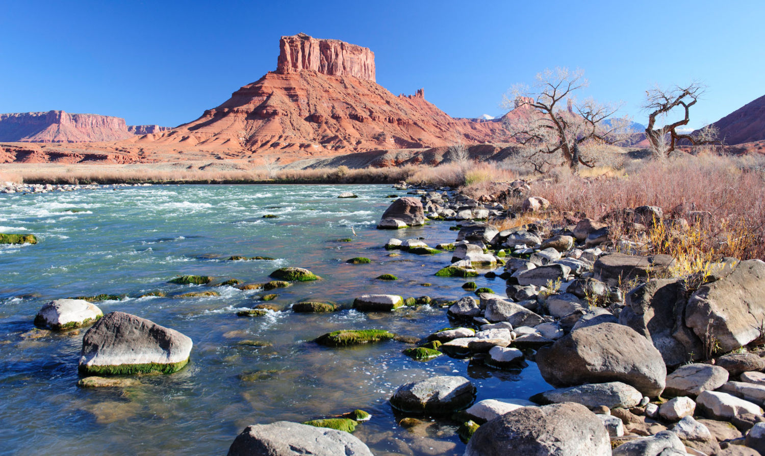
The Colorado River below Dead Horse Point in southeastern Utah. (Ted Wood)
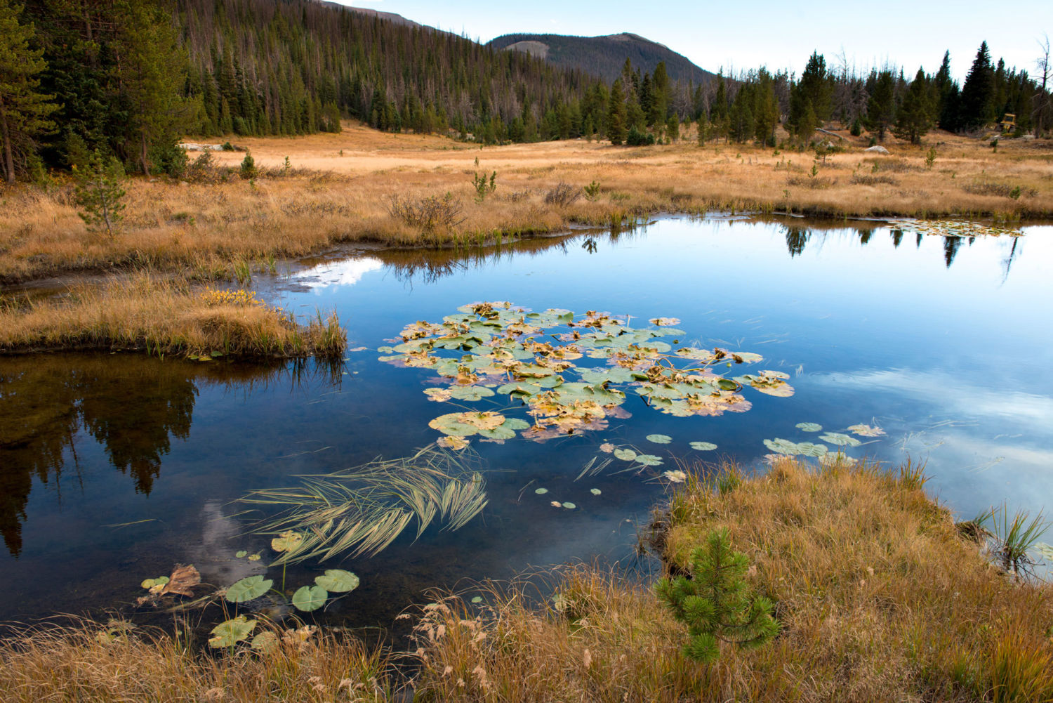
The beginnings of the mighty Colorado River on the west slope of Rocky Mountain National Park are humble. A large marsh creates a small trickle of a stream at La Poudre Pass, and thus begins the long, labyrinthine 1,450-mile journey of one of America’s great waterways.
Several miles later, in Rocky Mountain National Park’s Kawuneeche Valley, the Colorado River Trail allows hikers to walk along its course and, during low water, even jump across it. This valley is where the nascent river falls prey to its first diversion — 30 percent of its water is taken before it reaches the stream to irrigate distant fields.
The Never Summer Mountains tower over the the valley to the west. Cut across the face of these glacier-etched peaks is the Grand Ditch, an incision visible just above the timber line. The ditch collects water as the snow melts and, because it is higher in elevation than La Poudre Pass, funnels it 14 miles back across the Continental Divide, where it empties it into the headwaters of the Cache La Poudre River, which flows on to alfalfa and row crop farmers in eastern Colorado. Hand dug in the late 19th century with shovels and picks by Japanese crews, it was the first trans-basin diversion of the Colorado.
The Colorado River gathers momentum in western Colorado, sea-green and picking up a good deal of steam in its confluence with the Fraser, Eagle, and Gunnison rivers. As it leaves Colorado and flows through Utah, it joins forces with the Green River, a major tributary, which has its origins in the dwindling glaciers atop Wyoming’s Wind River Mountains, the second largest glacier field in the lower 48 states.
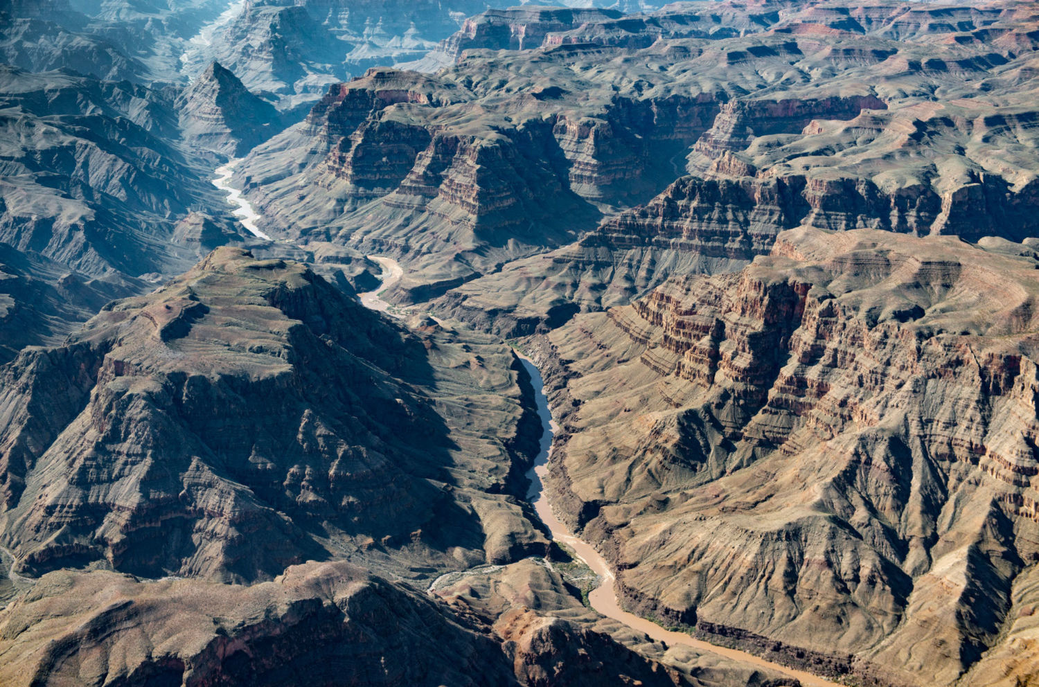
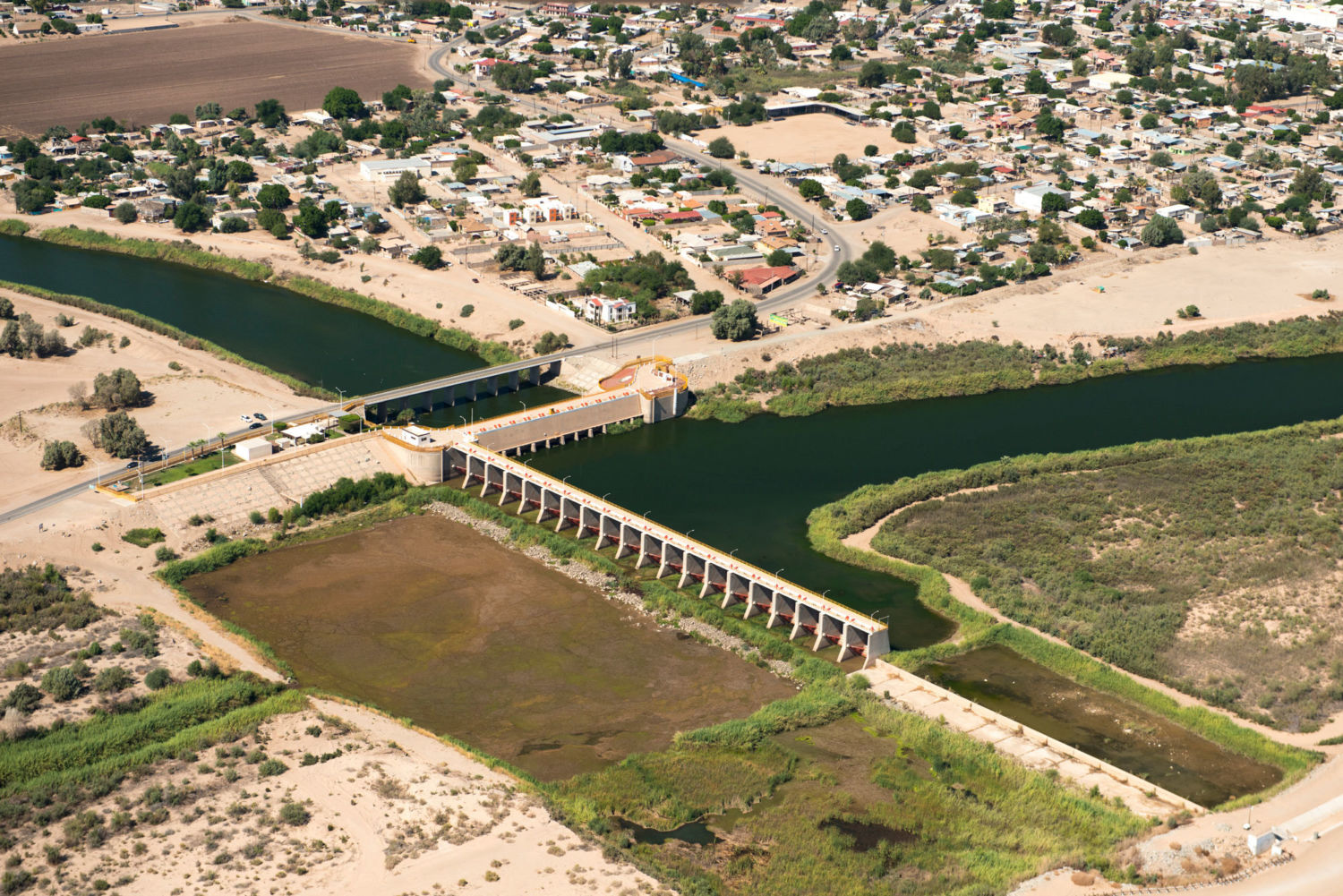
The now sediment-laden Colorado (“too thick to drink, too thin to plow” was the adage about such rivers) gets reddish here, and earns its name – Colorado means “reddish.” It heads in a southwestern direction through the slick rock of Utah and northern Arizona, including its spectacular run through the nearly 280-mile-long Grand Canyon, and then on to Las Vegas where it makes a sharp turn south, first forming the border of Nevada and Arizona and then the border of California and Arizona until it reaches the Mexican border. There the Morelos Dam — half of it in Mexico and half in the United States — captures the last drops of the Colorado’s flow, and sends it off to Mexican farmers to irrigate alfalfa, cotton, and asparagus, and to supply Mexicali, Tecate, and other cities and towns with water.
While there are verdant farm fields south of the border here, it comes at a cost. The expansive Colorado River Delta — once a bird- and wildlife-rich oasis nourished by the river that Aldo Leopold described as a land of “a hundred green lagoons” — goes begging for water. And there is not a drop left to flow to the historic finish line at the Gulf of California, into which, long ago, the Colorado used to empty.
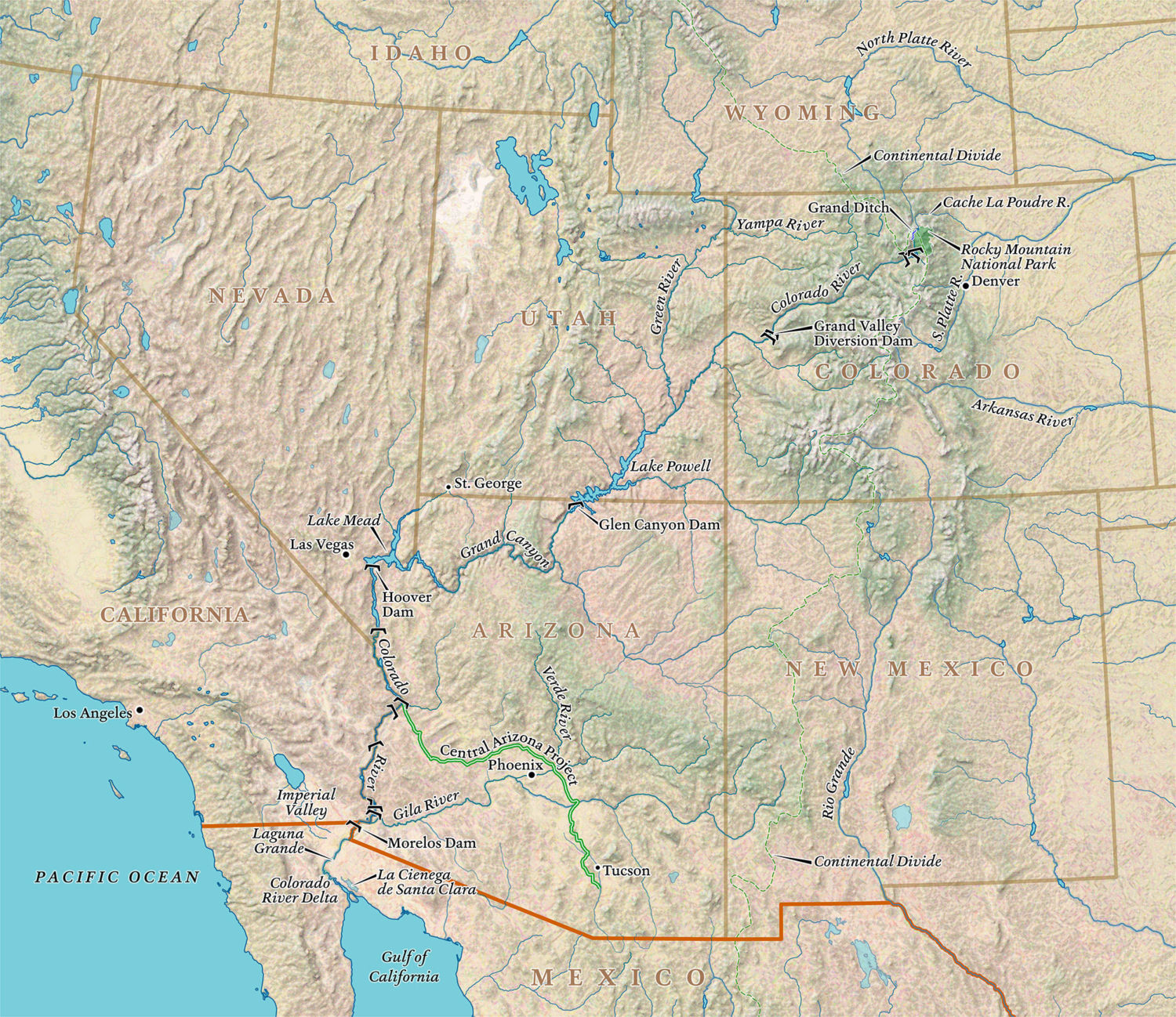
Nature, in fact, has been given short shrift all along the 1,450-mile-long Colorado. In order to support human life in the desert and near-desert through which it runs, the river is one of the most heavily engineered waterways in the world. Along its route, water is stored and siphoned, routed and piped, with a multi-billion dollar plumbing system — a “Cadillac Desert,” as Marc Reisner put it in the title of his landmark 1986 book. There are 15 large dams on the main stem of the river, and hundreds more on the tributaries.
The era of tapping the Colorado River, though, is coming to a close. This muddy river is one of the most contentious in the country — and growing more so by the day. It serves some 40 million people, and far more of its water is promised to users than flows between its banks — even in the best water years. And millions more people are projected to be added to the population served by the Colorado by 2050.
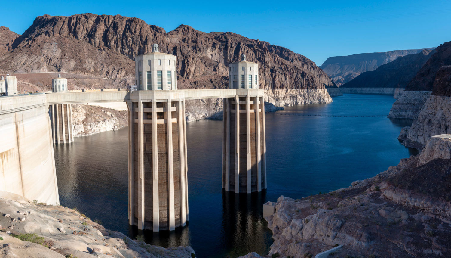
The hard lesson being learned is that even with the Colorado’s elaborate plumbing system, nature cannot be defied. If the over-allocation of the river weren’t problem enough, its best flow years appear to be behind it. The Colorado River Basin has been locked in the grip of a nearly unrelenting drought since 2000, and the two great water savings accounts on the river — Lake Mead and Lake Powell — are at all-time lows. An officially announced crisis could be at hand in the coming months.
Some scientists believe a long-term aridification driven by climate change may be taking place, a permanent drying of the West.
Meanwhile the Lower Basin states — Arizona, California, and Nevada — have, despite much debate, been unable to come up with a Drought Contingency Plan to keep water in Lake Mead below levels that would trigger a crisis and lead to mandatory cuts in water. And if the states do not agree on a plan by the end of this month, U.S. Bureau of Reclamation Commissioner Brenda Burman says she will step in and force hard decisions.
There are large, existential questions facing the 40 million people who depend on the river — there simply is not enough water for all who depend on it, and there will likely soon be even less.
Most of the water in the Colorado comes from snow that falls in the Rockies and is slowly released, a natural reservoir that disperses its bounty gradually, over months. But since 2000, the Colorado River Basin has been locked in what experts say is a long-term drought exacerbated by climate change, the most severe drought in the last 1,250 years, tree ring data shows. Snowfall since 2000 has been sketchy — last year it was just two-thirds of normal, tied for its record low. With warmer temperatures, more of the precipitation arrives as rain, which quickly runs off rather than being stored as mountain snow. Many water experts are deeply worried about the growing shortage of water from this combination of over-allocation and diminishing supply.
There is tree ring data to show that multi-decadal mega-droughts have occurred before, one that lasted, during Roman Empire times, for more than half a century. The term drought, though, implies that someday the water shortage will be over. Some scientists believe a long-term, climate change-driven aridification may be taking place, a permanent drying of the West. That renders the uncertainty of water flow in the Colorado off the charts. While not ruling out all hope, experts have abandoned terms like “concerned” and “worrisome” and routinely use words like “dire” and “scary.”
“These conditions could mean a hell of a lot less water in the river,” said Jonathan Overpeck, an interdisciplinary climate scientist at the University of Michigan who has extensively studied the impacts of climate on the flow of the Colorado. “We’ve seen declines in flow of 20 percent, but it could get up to 50 percent or worse later in this century.”
Even in rock-ribbed conservative areas, those who use the water of the Colorado say they are already seeing things they have never seen before — this year state officials in Colorado cut off lower-priority irrigators on the Yampa River, a tributary of the Green, and recreation had to be halted, for example — and have grudgingly come to believe “there is something going on with the climate.”
If water cuts are mandated, some states will be required to send others their allotted water, whether they have it to spare or not.
As the authors of a 2015 study on the region’s climate future put it: “Our results point to a remarkably drier future that falls far outside the contemporary experience of natural and human systems in Western North America, conditions that may present a substantial challenge to adaptation.”
So there are conventions and meetings and papers being written throughout the Colorado Basin, seeking an agreeable adaptive future for a river in crisis. One of the big rubs in an incredibly complex debate is this: In 1922, California was booming and helping itself to an increasing share of the water, while other states were growing far more slowly. The other basin states wanted to assure their share before California could suck it up and, with guidance from then-Secretary of Commerce Herbert Hoover, created a Colorado River Compact that divvied up 15 million acre-feet of water — 7.5 million to the Upper Basin States and the same amount to Lower Basin States.
It’s well known now that this Law of the River was a product of irrational Manifest Destiny exuberance, a false premise based on unrealistic projections, because it was signed in one of the wettest periods on the river in centuries. Yet the actual amount apportioned among the states is more than 16 million acre-feet, 1.2 million acre-feet over the too-optimistic apportionment. These extravagant numbers are baked into the system, something known officially as a “structural deficit.”
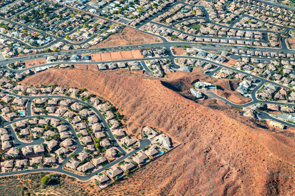
St. George, Utah has been growing rapidly, with subdivisions and golf courses pushing into the desert. Its population has grown from 20,000 to 150,000 in the last 20 years. Photo by Ted Wood
Support for Aerial Photographs provided by Lighthawk
This winter is make or break for the short term. A crisis is underway — record low flows were seen throughout last summer and fall. Another low- snow winter could light the fuse of a major crisis — an escalating crescendo of emergencies ending in a “compact call” when the lower basin states call on the upper basin states to send them their legally mandated allotment of water — whether they have it to spare or not. All of the players along the river are jockeying for “water security,” an oft-heard term in the region these days.
Cities from Tucson, Arizona, to St. George, Utah, to Denver are booming and need more water to keep growing. Municipal officials across the basin are apprehensive about the future of their growth economy in a time of an increasing likelihood of limits.
Another friction point is the fact that the Upper Basin States — Wyoming, Colorado, New Mexico, and Utah — still have “paper water,” meaning water owed to them by the 1922 compact, which they have not yet taken out of the river. And while many experts say no new straws should be dipped into the river to suck more water out, even if a state is entitled, there are plans afoot to do just that, setting up even more contention and wranglings.
Speculators are quietly buying up farms with water rights and holding them for the day that the price of water soars.
The future of farms and ranches that depend on Colorado River water is most uncertain. Agriculture uses about 80 percent of the Colorado’s flow to irrigate 6 million acres of crops, the largest share of which is alfalfa grown to feed cattle; cities use just 10 percent. While agriculture’s rights are senior — it staked the first claims and so, by law, is the last to lose its water in a crunch — if the going gets tough and cities start running out of water, political and economic clout would favor the millions of people who live there. In that case, agriculture would start losing some of its allotment, either willingly or unwillingly.
“You don’t have to be a rocket scientist to see that there is going to be pressure on your water,” says Mark Harris, general manager of the Grand Valley Water Users Association, a group of irrigators in western Colorado trying to adapt to a new era. “We have a target on our back.” Dewatering agriculture could lead not only to the buying and drying of farms, but the collapse of many small towns whose raison d’être is growing food.
And then there is the recreation industry, a $26 billion part of the Colorado River economy. Last year, raft companies had to reduce their season and cut back the number of trips on the river because of diminished flows.
Meanwhile, speculators and investors have waded into this complex “Chinatown”-like scenario, and are playing a quiet, though growing, role. Hedge funds and other interests, a breed of vulture capitalists, are quietly buying up farms with water rights, and holding them for the day things become more dire and the price of an acre-foot of water soars.
Crisis on the Colorado
A five-part series from Yale Environment 360

Part I: The West’s Great River Hits Its Limits: Will the Colorado Run Dry?
Part II: On the Water-Starved Colorado River, Drought Is the New Normal
Part III: Running Dry: New Strategies for Conserving Water
Part IV: In Era of Drought, Phoenix Prepares for a Future Without Colorado River Water
Part V: Restoring the Colorado– Bringing New Life to a Stressed River
Lastly are the natural attributes of the Colorado River. The needs of fish, wildlife, and native flora have always been at the bottom of the priority list, lost to the needs of booming cities and thirsty crops. That’s changing, as a growing number of people and organizations are working to carve out a future for a more natural river — from the sandy beaches of the Grand Canyon, to the endangered fish along the river’s length, to the birds and jaguars of the Colorado River Delta in Mexico.
The bill for a century of over-optimism about what the river can provide is coming due. How the states will live within their shrinking water budget will depend on how severe the drought and drying of the West gets, of course. But however the climate scenario plays out, there is a good deal of pain and radical adaptation in store, from conservation, to large-scale water re-use, to the retirement of farms and ranches, and perhaps an end to some ways of life. Worst case, if the reservoirs ever hit “dead pool” — when levels drop too low for water to be piped out — many people in the region could become climate refugees.
“I hate to use the word dire, because it doesn’t do justice to the good-thinking people and problem solvers that exist in the basin, but I would say it is very serious,” said Brad Udall, a senior scientist at the Colorado Water Institute. “Climate change is unquantifiable and puts life- and economy-threatening risks on the table that need to be dealt with. It’s a really thorny problem.”
Read Next: On the Water-Starved Colorado River, Drought Is the New Normal
CLICK IMAGES TO LAUNCH GALLERY

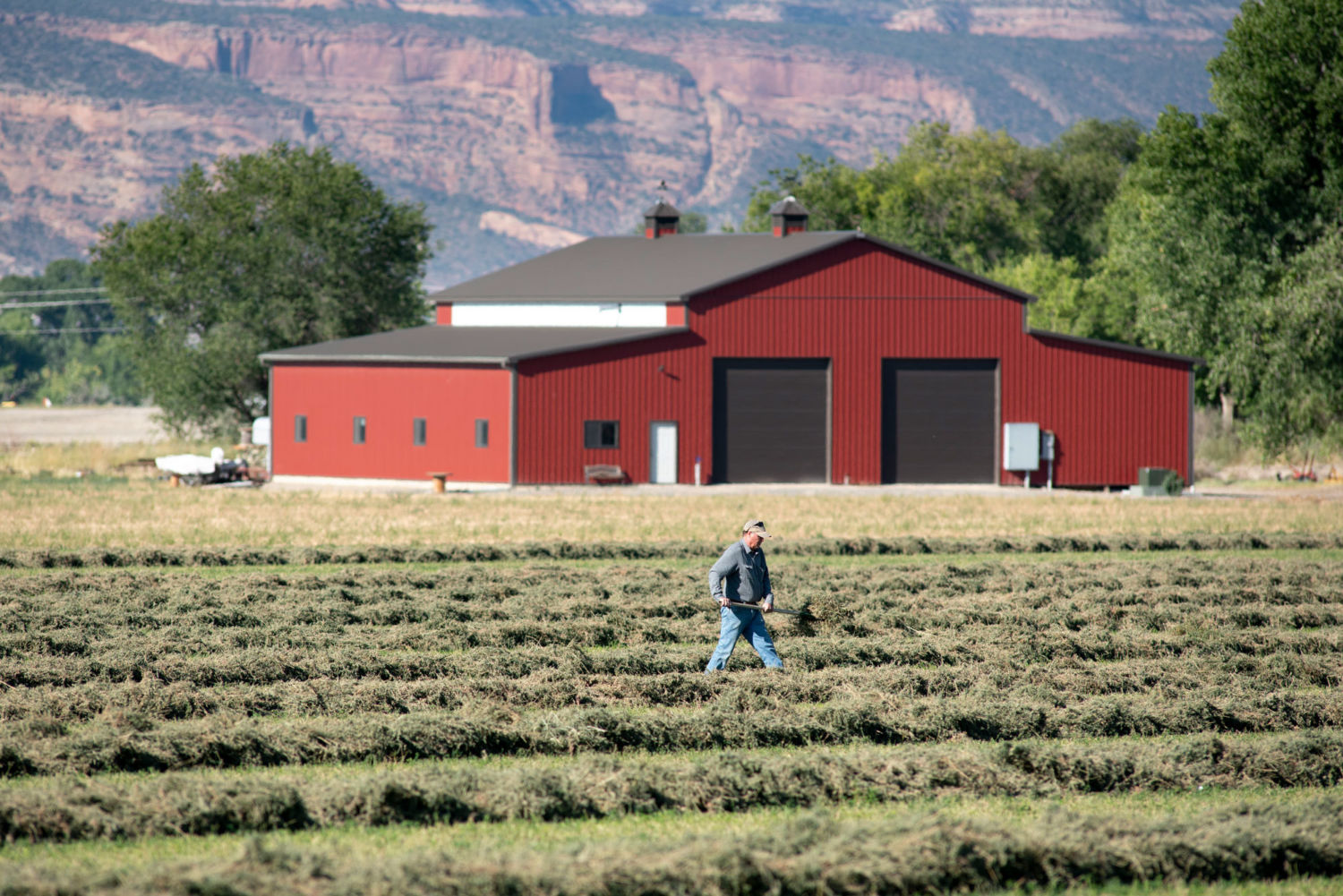
A farmer in Grand Junction, Colorado, works his alfalfa field, which is irrigated with water diverted from the Colorado River. To reduce water usage, some farmers are leaving their fields fallow in exchange for monetary compensation. PHOTO BY TED WOOD 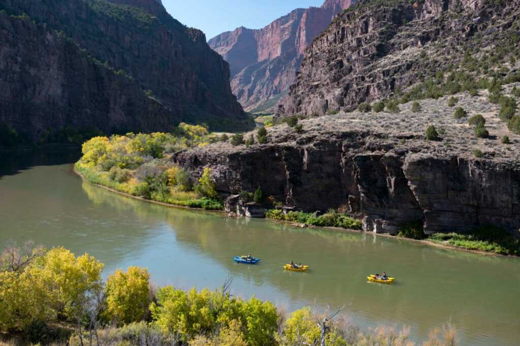
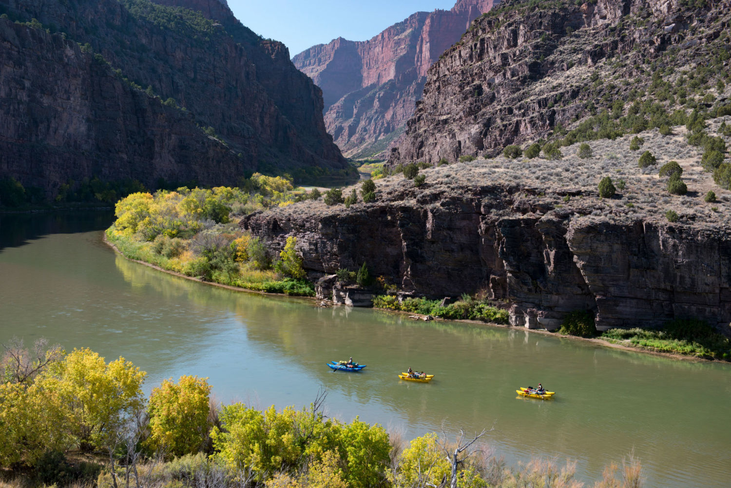
Kayakers on the Green River, a main stem of the Colorado, at the Gates of Lodore in northwest Colorado. Low water levels have forced some bans on recreational uses. PHOTO BY TED WOOD 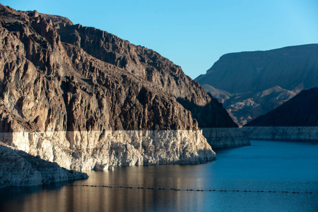
A white ring around the 112-mile perimeter of Lake Mead shows how far water levels have dropped because of drought conditions that have persisted since 2000. PHOTO BY TED WOOD 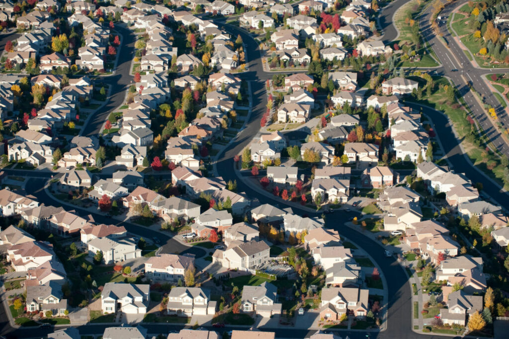
Development is mushrooming along Colorado’s Front Range north of Denver, with the water needs of the new communities being met by diversions from the Colorado River. PHOTO BY TED WOOD The Colorado River passes through the Hualapai Indian Reservation in northern Arizona, west of Grand Canyon National Park. PHOTO BY TED WOOD 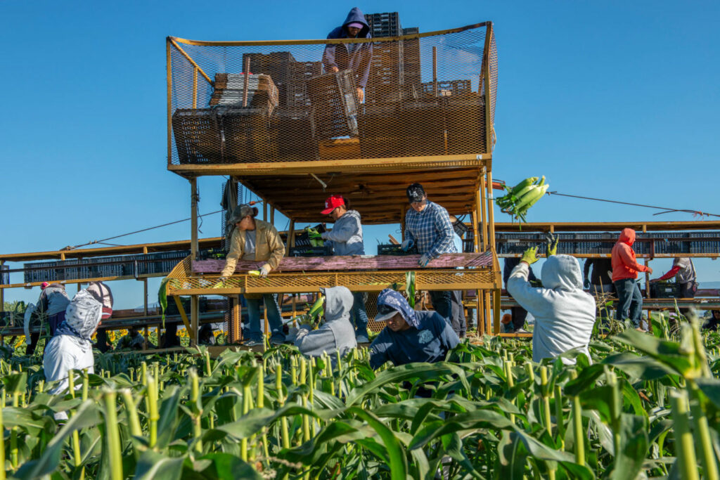
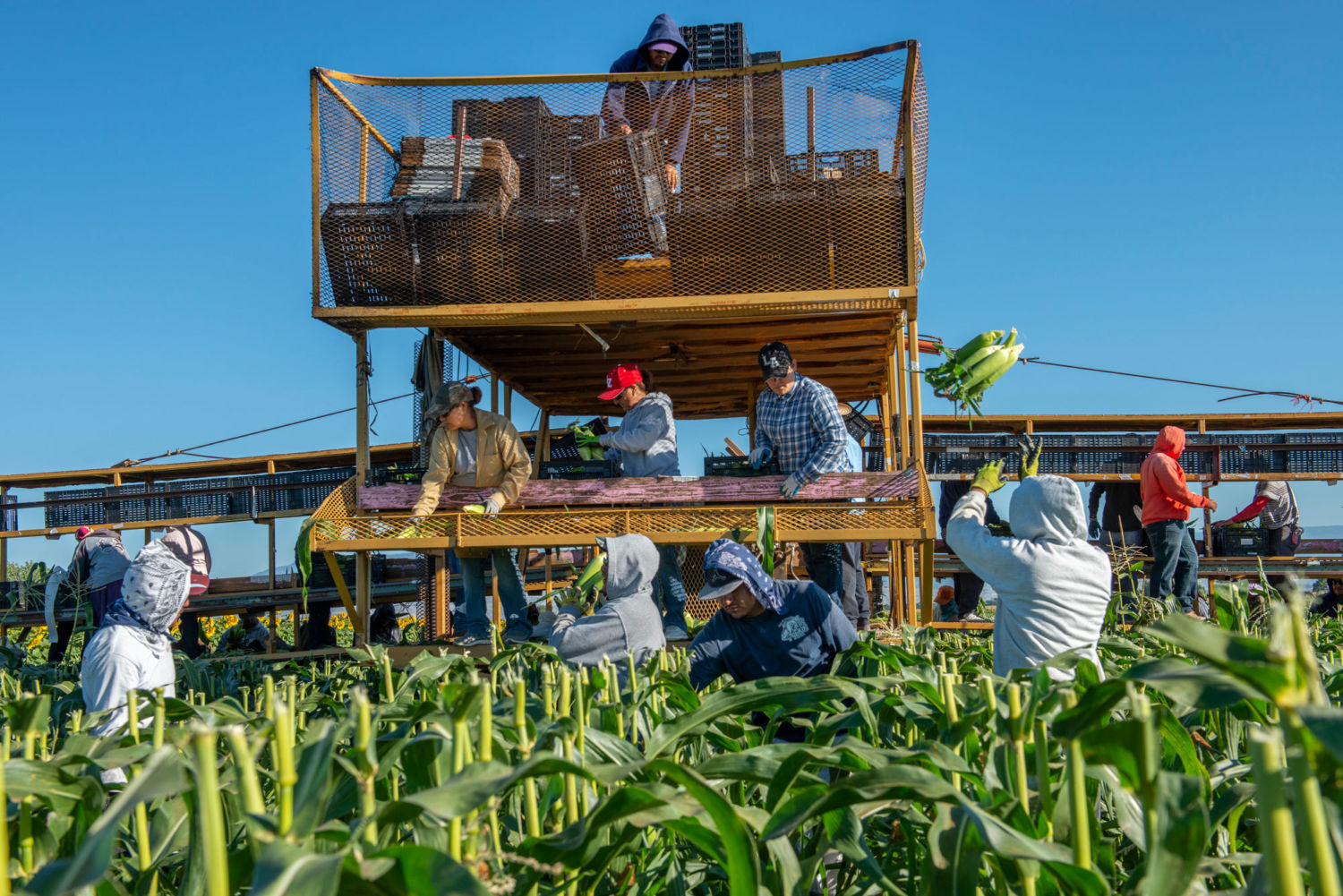
Farmworkers pick sweet corn in Colorado’s Gunnison Valley. The Gunnison is a major tributary of the Colorado, which it joins at Grand Junction. TED WOOD 
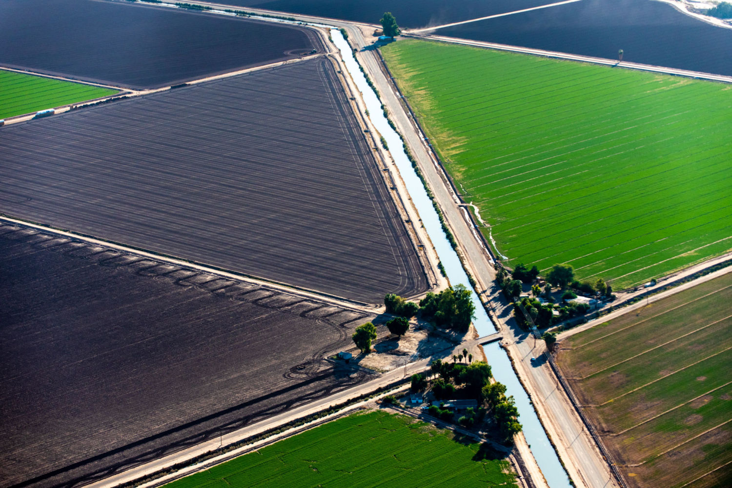
The 80-mile-long All-American canal takes water from the Colorado River to California’s Imperial Valley, a major sources of U.S. fruits, vegetables, and cotton. PHOTO BY TED WOOD 
The Morelos Dam at the U.S.-Mexico border is the last major diversion of Colorado River water, channeling water for the city of Mexicali and agricultural users in Mexico. PHOTO BY TED WOOD 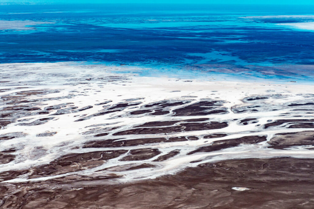
The Colorado River once flowed into the Gulf of California, but now its dried-up delta is a desiccated landscape of old river channels, salt tidal flats, and mineral deposits. PHOTO BY TED WOOD


Crisis on the Colorado is reprinted with the permission of Yale Environment 360.
Support for aerial photos was provided by Lighthawk.
Jim Robbins (@JimRobbins19) is a veteran journalist based in Helena, Montana. He has written for the New York Times, Conde Nast Traveler, and numerous other publications. His latest book is The Wonder of Birds: What they Tell Us about the World, Ourselves and a Better Future.
Ted Wood (tedwoodphoto.com) is a photojournalist and multimedia producer based in Boulder, Colorado. He specializes in environmental and conservation stories, particularly in the western United States. His work has appeared in Vanity Fair, Smithsonian, Audubon, and dozens of other national and international publications. Wood is also the co-founder of The Story Group, a multimedia journalism company in Boulder.
Longform Story CSS Block


")
")
")
")
")
")
")
")


